The Rock Creek Project encompasses nearly 16 miles of fish habitat on Rock, Little Rock, Sheep, Graves, and Little Graves creeks within the UGC-2 and UGS-16 recovery plan assessment units. UGS-16 has been identified by the BiOp Expert Panel as one of the highest priority geographic units to protect and restore summer steelhead habitat. UGC-2 is identified as having high intrinsic potential for Chinook in the lower reaches of Rock Creek and low to medium intrinsic potential for Chinook within upper stream reaches. Rock creek is located in Upper Grande Ronde within Atlas Biologically Significant Reach 12, Tier 3. Phase 3 of the project, constructed in 2018, addressed habitat limiting factors within a one mile reach of Rock Creek, beginning approximately 0.25 miles upstream from the confluence with the Grande Ronde River, 6.8 miles west of La Grande, Oregon and is located on privately owned land.
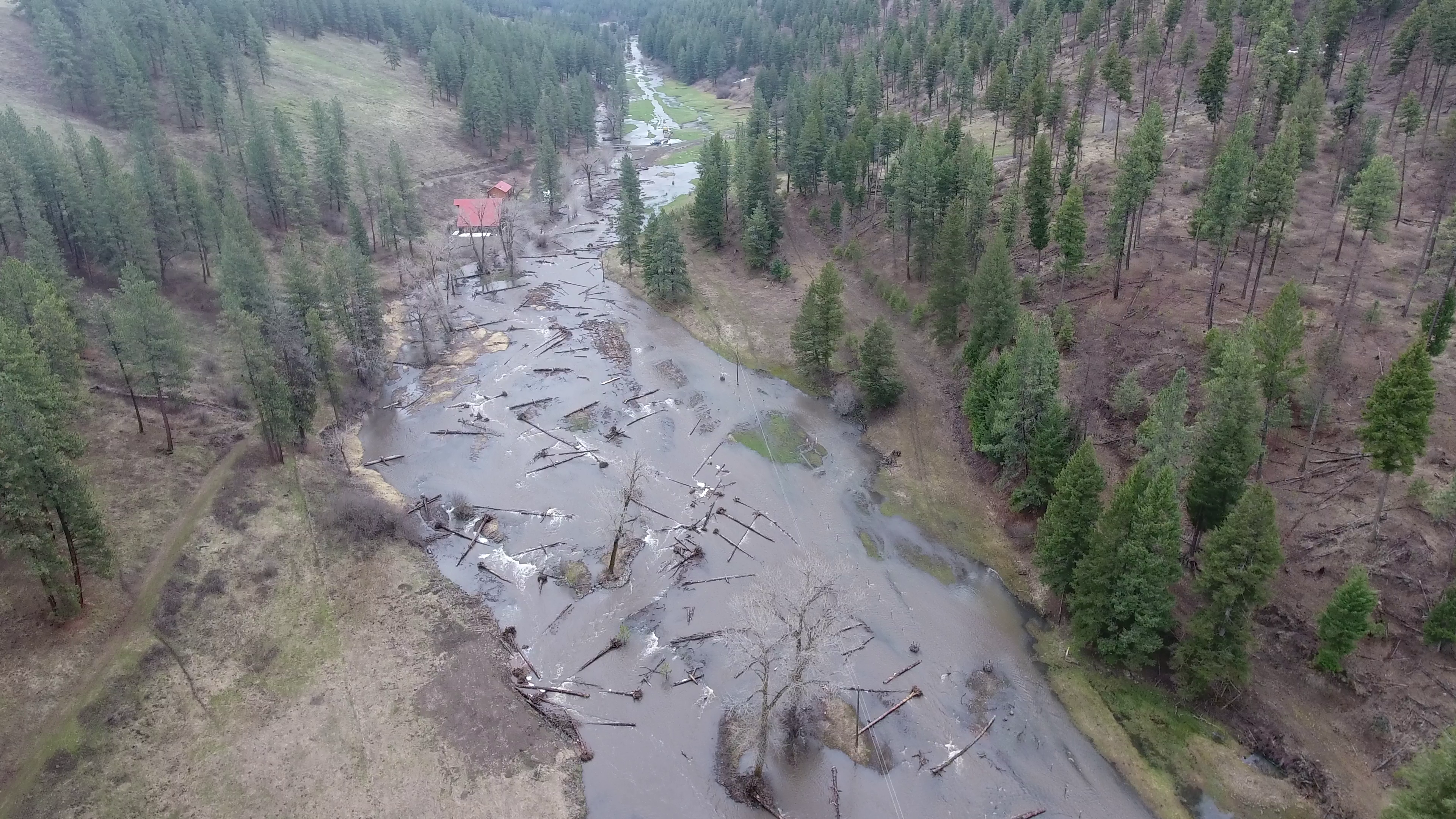
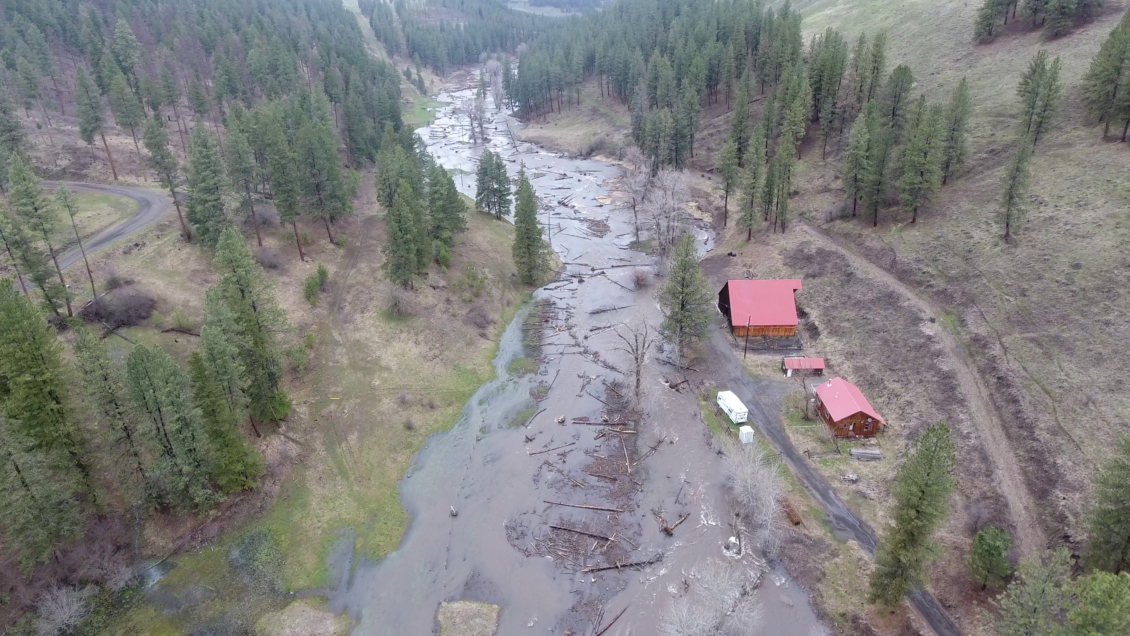
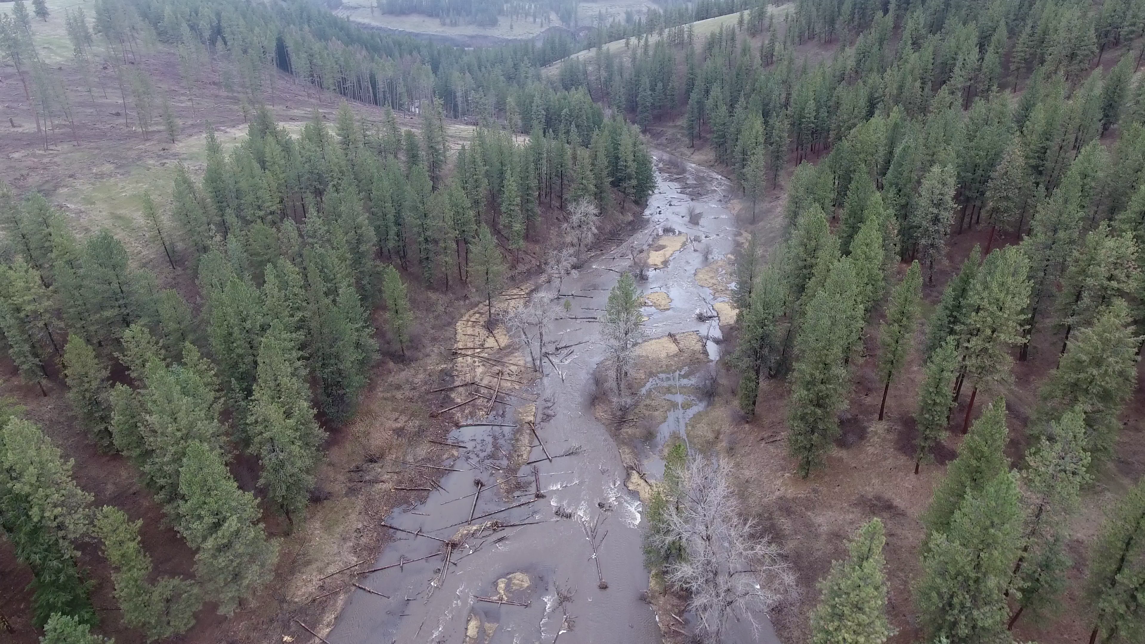
Fish habitat and productivity in the Rock Creek watershed has been severely altered. The lower 3 miles of Rock Creek were historically channelized by draw bottom road construction, installation of levees and utilities (power lines, gas pipelines, fiber optics), and agriculture. Anthropogenic alternations have contributed to floodplain confinement, channel entrenchment, increased slope, coarsened streambed sediment and loss of spawning habitat, streambank erosion, loss of wetland and riparian plant communities, poor thermal diversity, chronic summer high water temperatures and generally homogenized and degraded fish habitat.
Restoration objectives included maintaining and expanding current CTUIR/BPS riparian easement fence to protect the newly widened channel meander alignment and adjacent floodplain, enhance riparian conditions by broadcast seeding all ground disturbed areas, decommissioning levee and road grade, and installing in-stream willow bank treatments. Additional objectives sought to enhance in-stream structural diversity, complexity, and geomorphic stability by installing large wood and riffle-boulder complexes to provide roughness, overhead cover, and velocity diversity. Project design intended to develop new main channel meander bends that would increase channel sinuosity, decrease channel slope, and assist in floodplain reconnection and the development of more diverse channel structure and hydraulic variability. Design intentions additionally sought to reduce streambank erosion rates using bioengineering techniques, planting and seeding, reconnecting floodplain, and protecting riparian habitat by expanding the easement fence. Water quality was further addressed with the objective to improve and increase channel and floodplain interactions to diversify hyporheic exchange, including facilitating preferential flow from hillside cold water spring seeps into alcoves, side channels, and main channel, promoting vegetative cover and shade, and decreasing channel width to depth ratio to lower summer stream temperatures and increase winter temperatures.