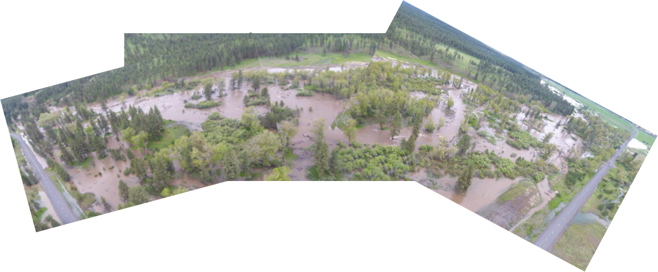
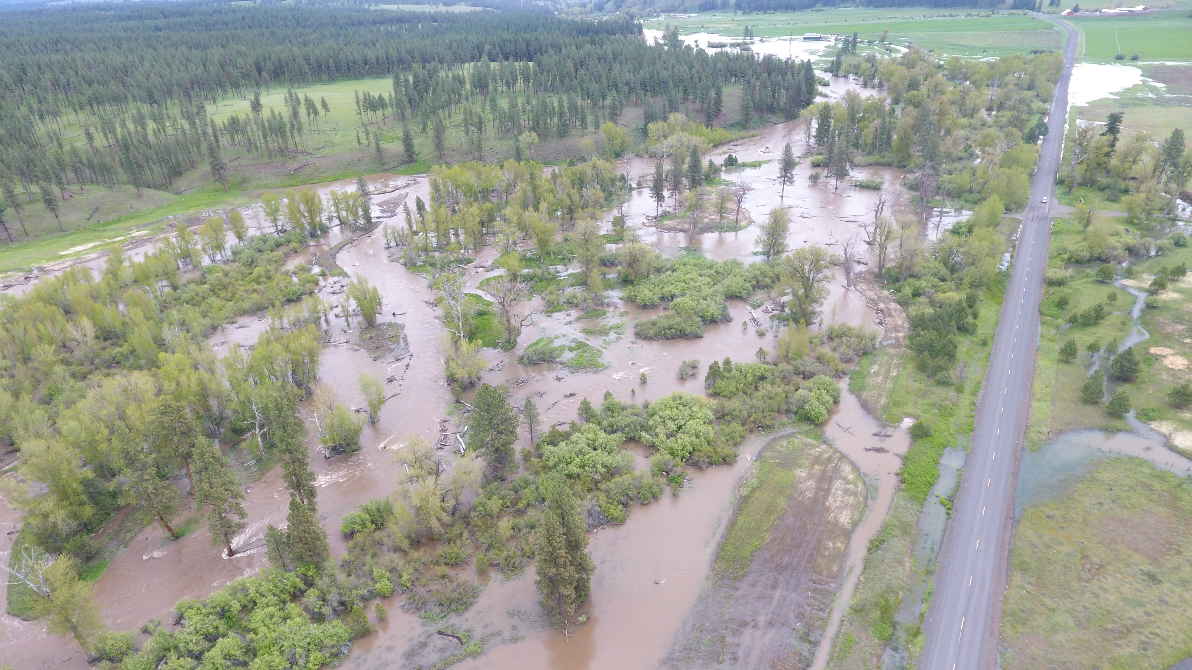
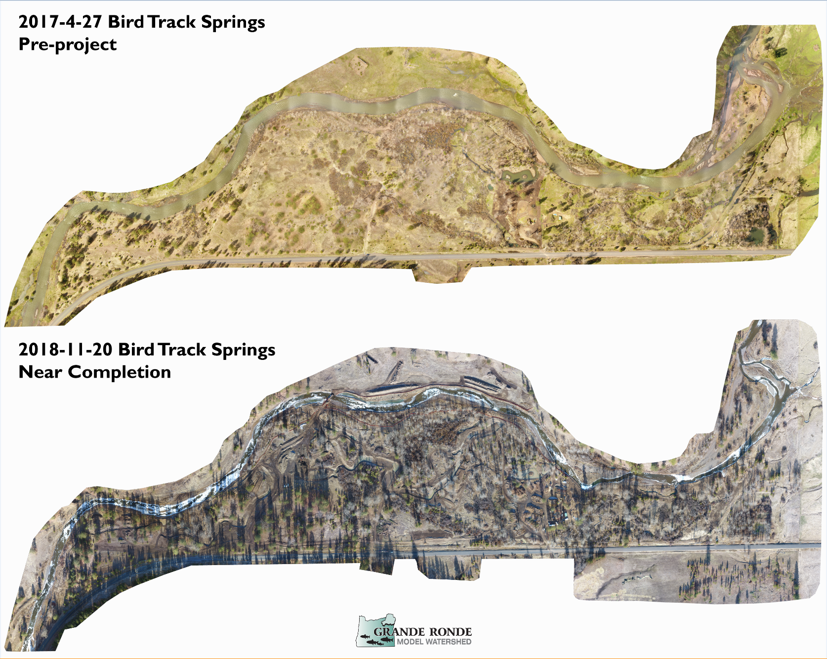
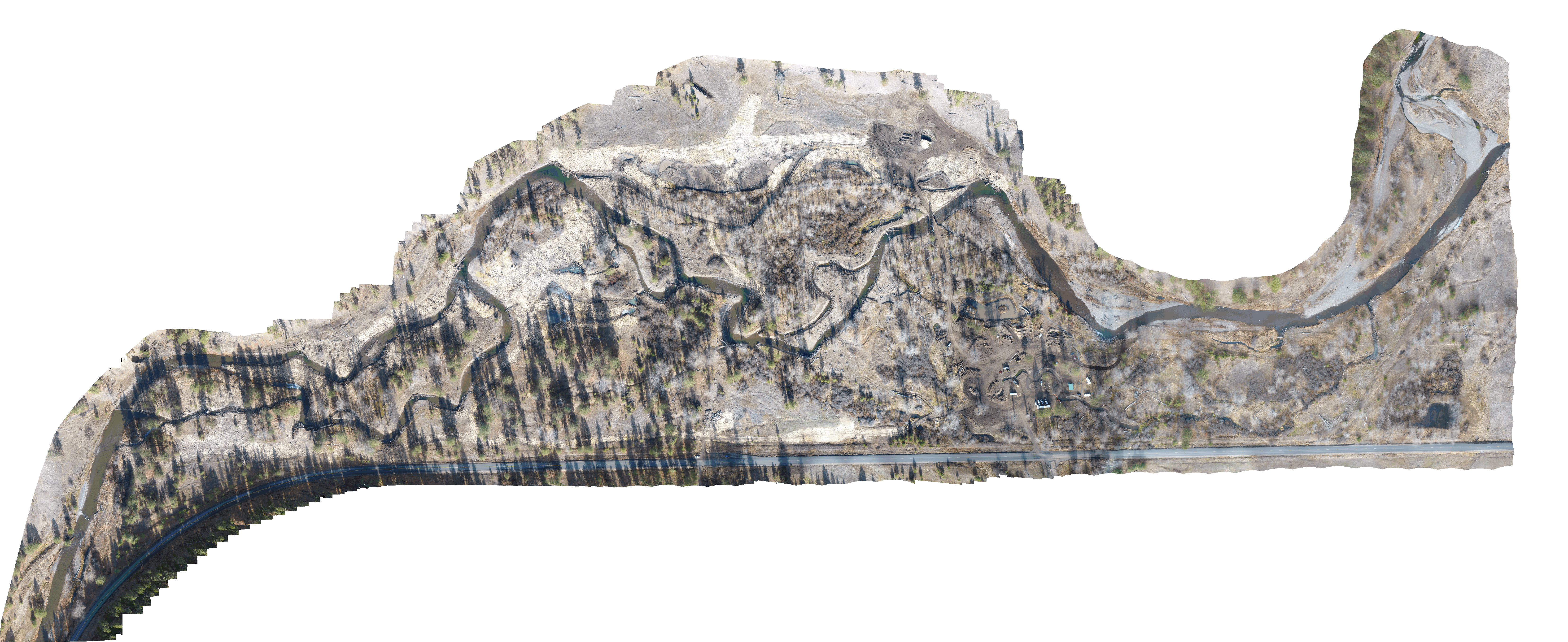
The Bird Track Springs (BTS) Project Area is located along approximately 1.9 miles of the Grande Ronde River adjacent to State Highway 244. The area encompasses 1.2 miles of river on Wallowa-Whitman National Forest (WWNF) system lands and 0.7 miles on privately-owned lands along the reach beginning at river mile 146.1 downstream to river mile 144.2. The project seeks to enhance habitat within UGR Atlas BSR Assessment Unit 11, an area that provides critical winter habitat for juvenile spring Chinook salmon and a significant opportunity to increase cold water refuge for summer rearing.
Historic floodplain and stream channel alterations, including but not limited to, systematic removal of beavers, channelization, historical logging and splash-dams, agriculture, railroad and road construction, livestock grazing and vegetation clearing, and placer mining, have contributed to habitat degradation and loss of habitat suitability and capacity to support recovery of spring Chinook salmon, steelhead and bull trout. Sediment, water temperature, low stream flows and, channel morphology and large wood/completed (habitat quality and quantity) are the most critical limiting factors for these salmonid populations.
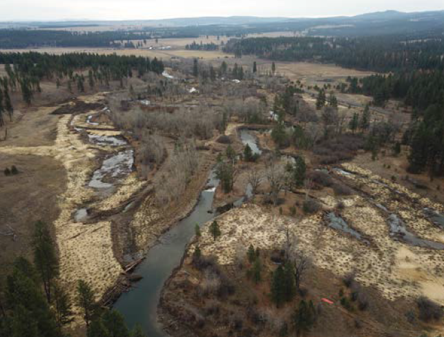
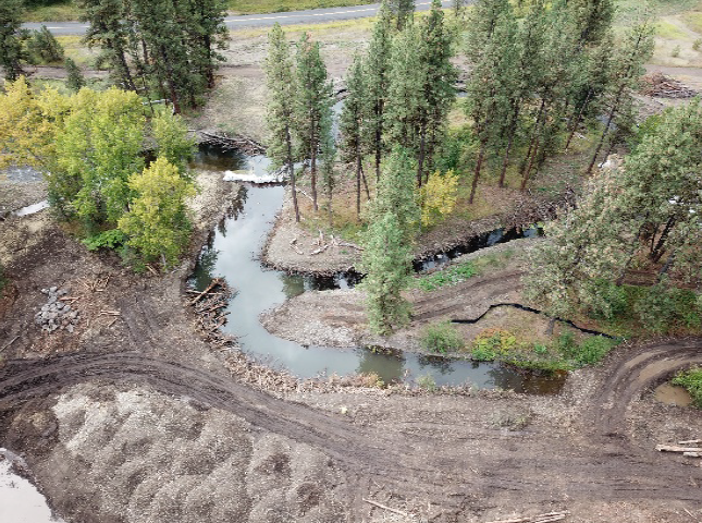
Restoration objectives seek to promote instream structural diversity and complexity by reconnecting historic floodplain and side channel network, promoting natural channel function and form, increasing instream and floodplain structural diversity through large wood complex additions that promote roughness, scour, sorting and storage of sediment, and development of a diverse assemblage of riffle, pool, glide, side channel, and alcove habitats. Increasing hydrodynamic diversity and function will alleviate summer maximum water temperatures, increase winter water temperatures, discourage anchor ice formation, and moderate and buffer diurnal water temperature fluctuations during both summer and winter rearing periods. Over-widened plane-bed channel form was converted into multi-thread and island-braided system with decreased width to depth ratios that will increase the inundation frequency and duration of historic floodplain while promoting the interaction and function of hyporheic groundwater exchange. Project actions will facilitate development of diverse and abundant native plant communities and seral stages that contribute to the floodplain process and function. In conjunction with natural channel and floodplain objectives, a combination of riparian and wetland habitat protection, planting and seeding, and natural recruitment will result in increased tree, shrub, and herbaceous plant communities that are resilient and self-sustaining, contributing to shade, structure, terrestrial food web, streambank stability, and future large wood recruitment. Additional objectives seek to increased habitat suitability and beaver recolonization that will complement restoration activities and reinvigorate natural habitat forming processes that create floodplain wetlands, pools, and vegetation diversity. Off-channel pools and wetland complexes created and maintained by beaver provide deep, low velocity habitat, instream and floodplain complexity and buffer high summer and low winter water temperatures.