Middle Upper Grande Ronde River Phase I
The project is located on the Wallowa-Whitman National Forest in the Upper Grande Ronde River Atlas Biological Significant Reach UGR15, along the Grande Ronde River between RM 156 and RM 158 and included 0.30 miles of lower Fly Creek, a tributary.

The project is located in the Upper Grande Ronde Subbasin along the Grande Ronde River between RM 156 and RM 158 and included 0.30 miles of lower Fly Creek, a tributary. The Project reach is located on the Wallowa-Whitman National Forest within the Upper Grande Ronde River Atlas Biological Significant Reach UGR15. Fish habitat suitability within the Project reach has been significantly affected and suppressed by physical alterations of the river and its associated floodplain (splash dam logging, mining, and road construction) that have contributed to severely degraded habitat conditions. Problems include homogenous, high energy, plane bed riffle-run channel types with a lack of large pool habitat, channel complexity, peripheral habitat bed armoring and alteration of sediment sorting and coarsening of streambed gravel, altered groundwater and hyporheic function, and degradation of riparian and wetland plant communities. Restoration objectives include increasing or enhancing large pools, side channels, complexity, and physical and hydraulic diversity. Project actions promote diverse geomorphic processes, features, and patterns of sediment movement, sorting and deposition in stream channels and floodplain. Additional objectives include physical, geomorphic, and ecologic conditions that buffer diurnal and seasonal water temperature fluctuations and allow access to cold water spring sources, and to re-connect floodplain and side channels to provide off channel habitat, natural flooding Actions will reinvigorate riparian vegetation establishment to support overall bank stability, particularly in locations where habitat structures have been installed and along banks with increased hydraulic roughness that are susceptible to erosion from loss of root mass.
Project Lead: CTUIR
First Foods this project targets
| Water | |
| Salmon | |
| Deer | |
| Roots | |
| Berries |
River Vision Touchstones this project targets
| Hydrology | |
| Geomorphology | |
| Connectivity | |
| Aquatic Biota | |
| Riparian Vegetation |
No funders found.
File Library
| Title | File | Description |
|---|---|---|
| MUGRR Design Drawings | Middle Upper Grande Ronde As Built Drawings.pdf | Uploaded file Middle Upper Grande Ronde As Built Drawings.pdf |
| MUGRR I Design Drawings - Boulder Addition and Anchoring | MUGR 2021 Project_reduced.pdf | Uploaded file MUGR 2021 Project_reduced.pdf |
| MUGRR Overview Map | MUGRR Overview Map 01312018.pdf | Uploaded file MUGRR Overview Map 01312018.pdf |
| MUGRR Presentation 2019 | MUGR Presentation 2019.pdf | Uploaded file MUGR Presentation 2019.pdf |
| MUGRR Project Summary Snapshot | MUGRR Snapshot.pdf | Uploaded file MUGRR Snapshot.pdf |
| MUGRR Tour Handout 2019 | MUGR Handout 2019.pdf | Uploaded file MUGR Handout 2019.pdf |
Image Gallery
| Title | File | Description |
|---|---|---|
| MUGGR Overview Map | 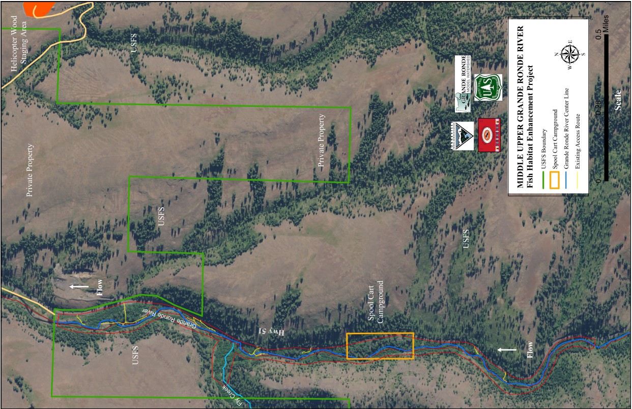 | Uploaded file MUGRRoverviewmap.jpg |
| MUGRR Aerial Photo | 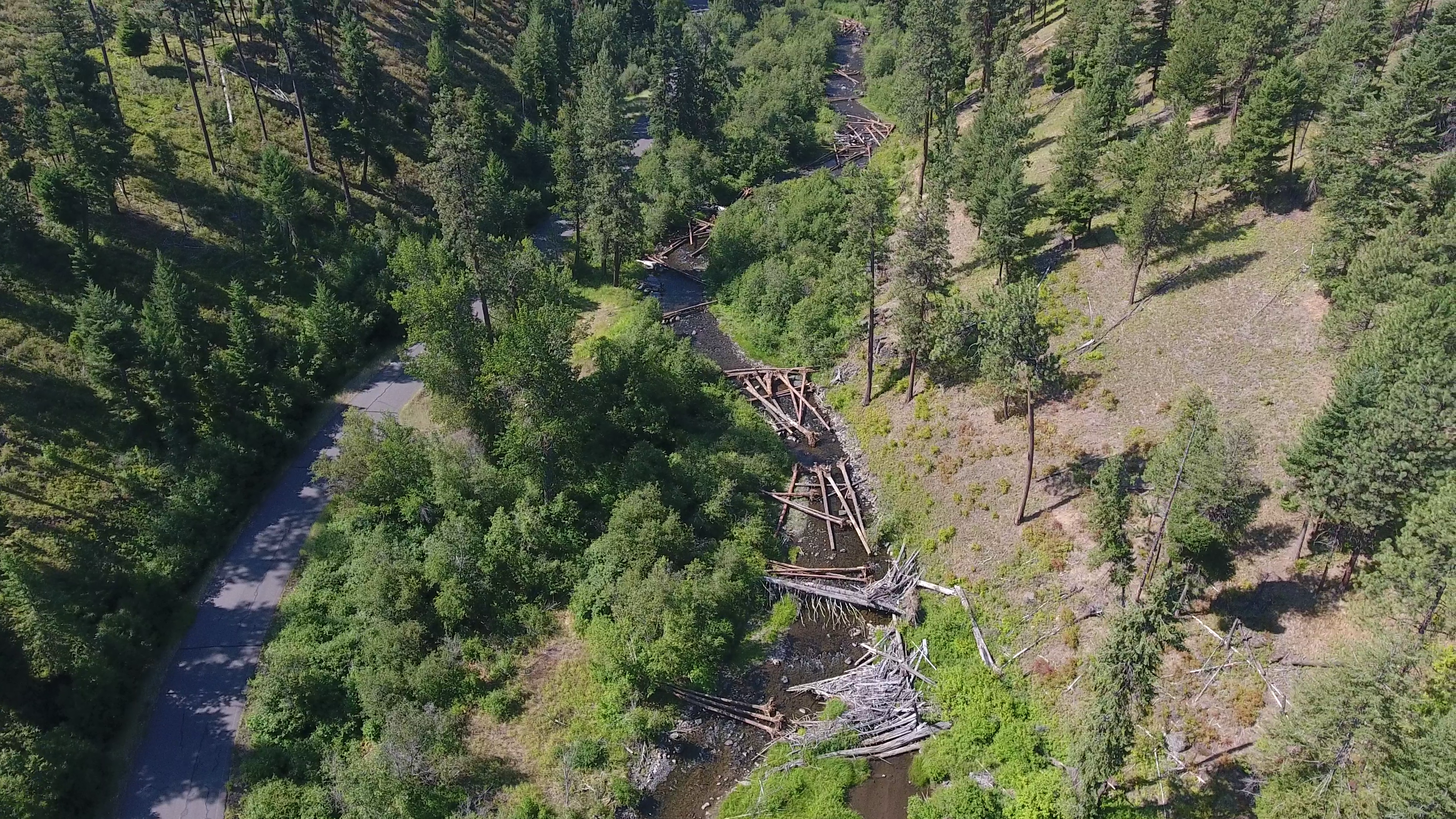 | Uploaded file MUGR Drone 1.png |
| MUGRR Aerial Photo | 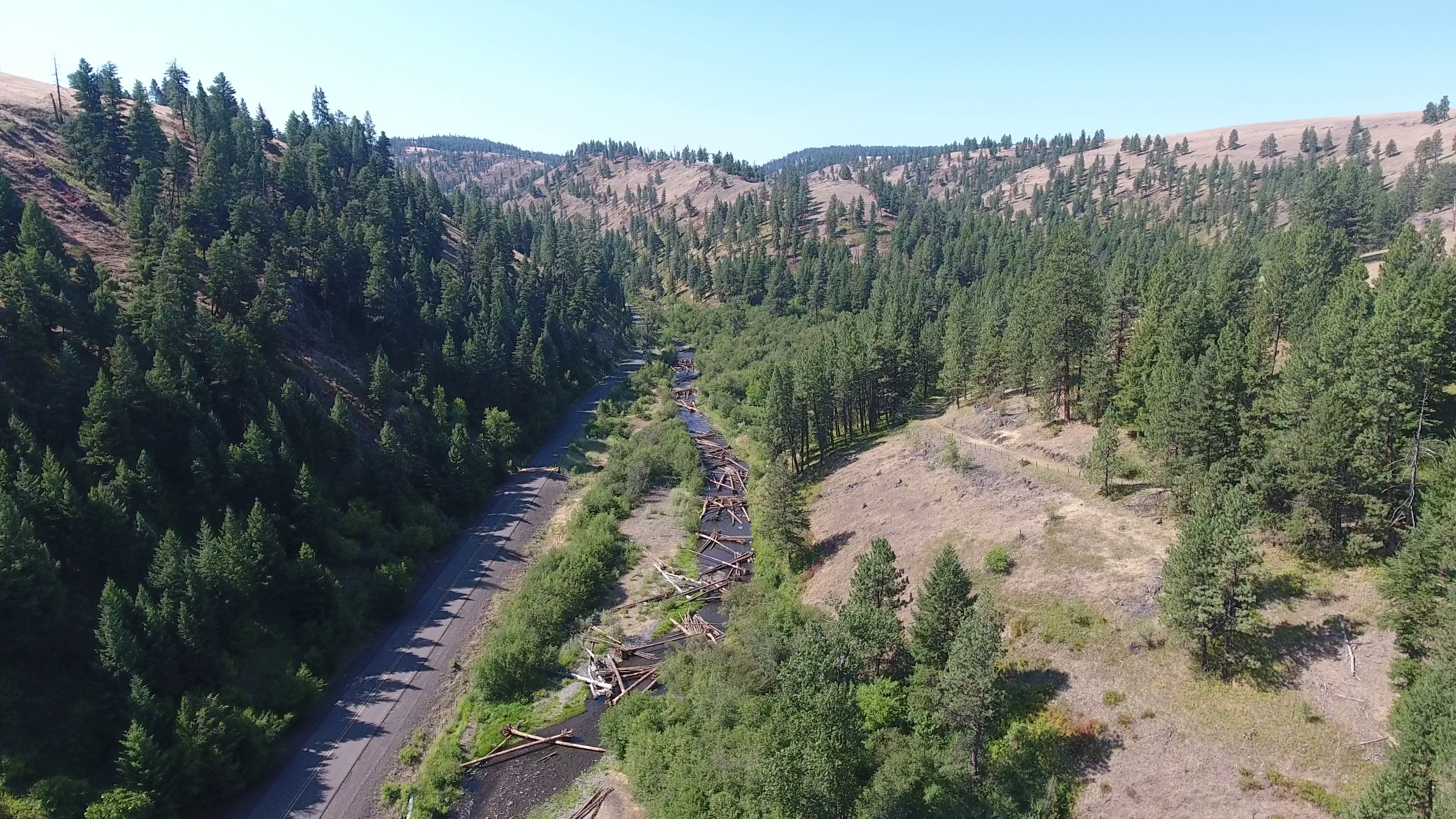 | Uploaded file MUGR Drone 2.png |
| MUGRR Aerial Photo | 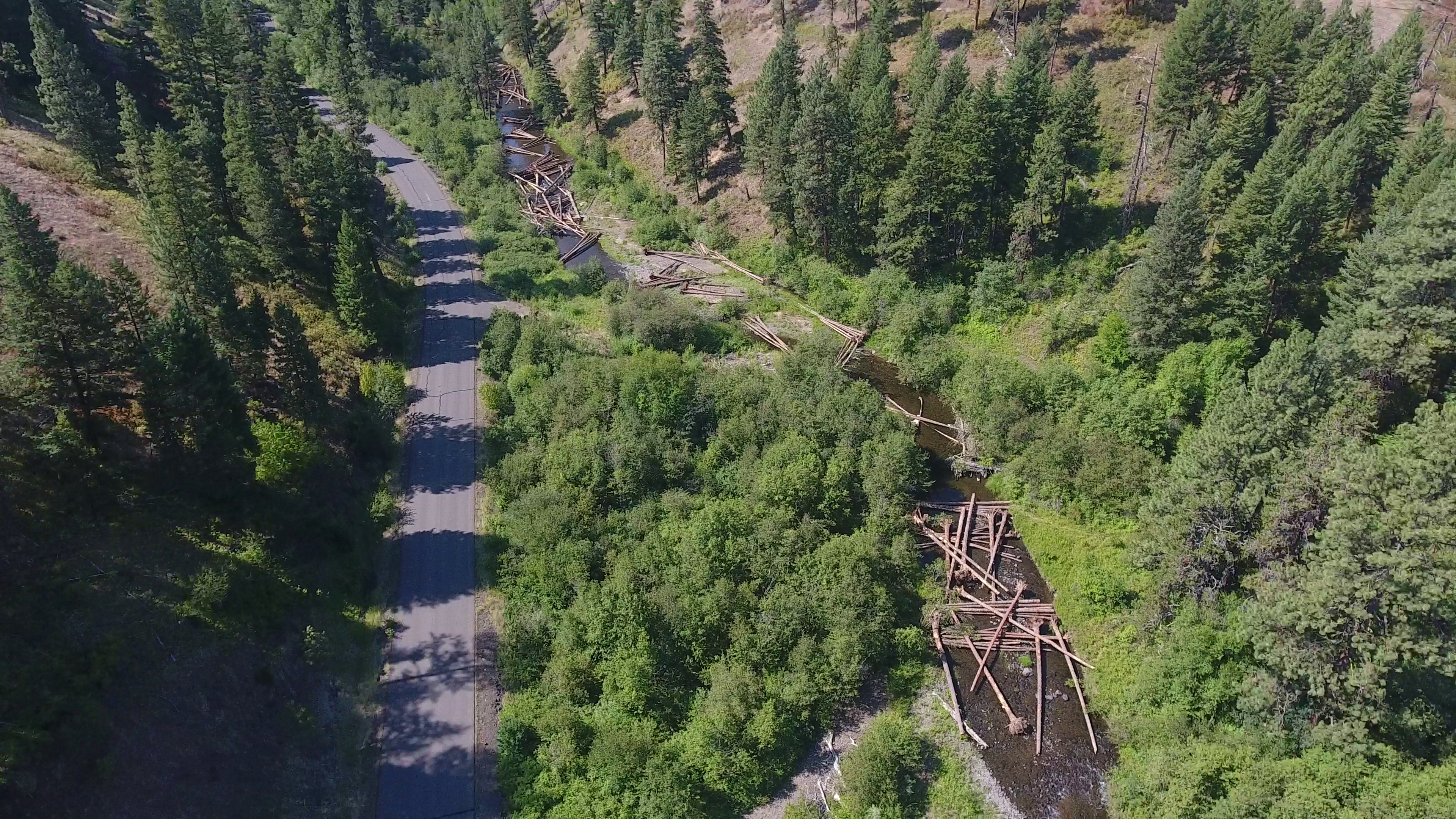 | Uploaded file MUGR Drone 3.png |
| MUGRR Aerial Photo | 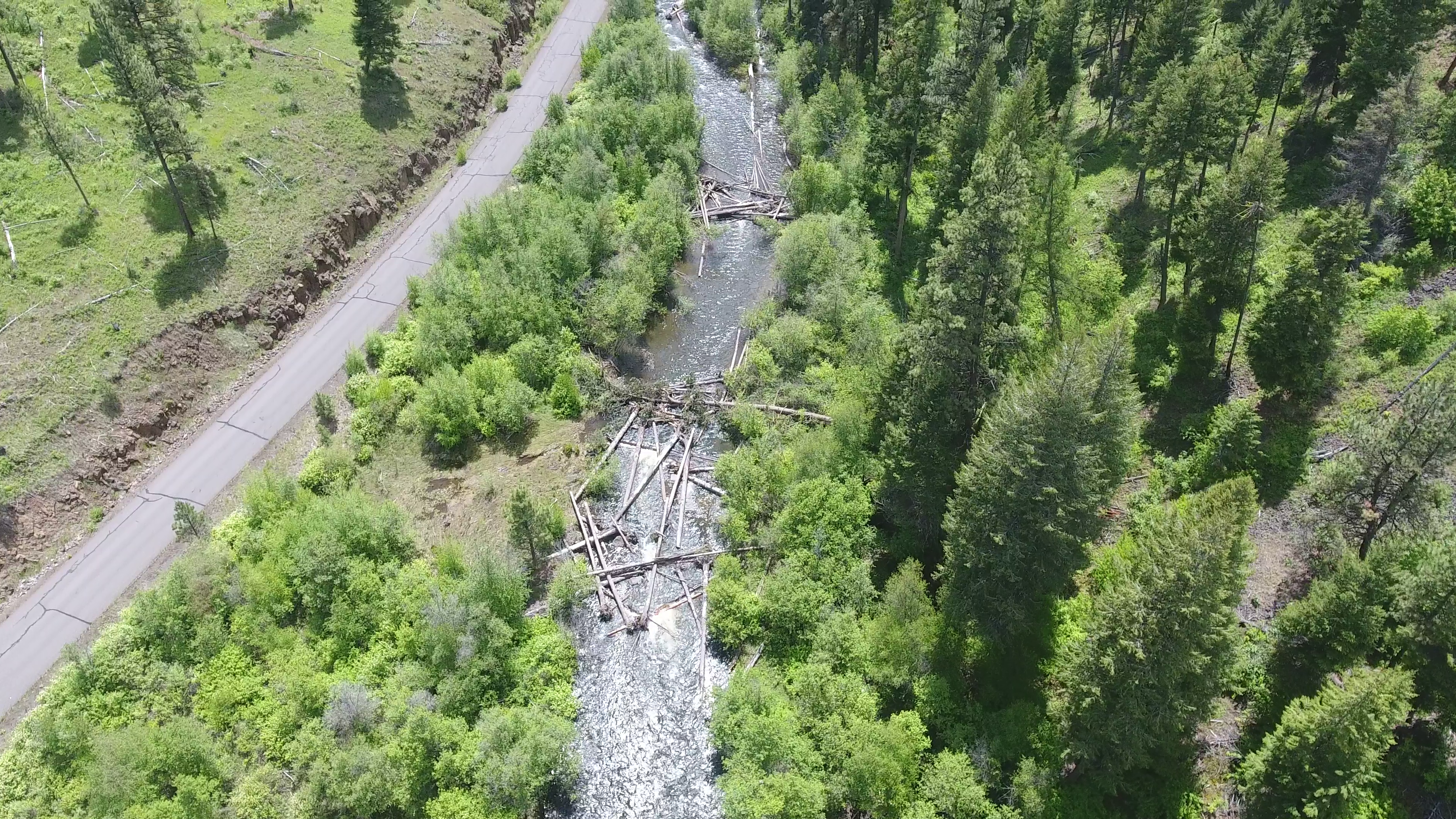 | Uploaded file MUGR Drone 4.png |
| MUGRR Aerial Photo | 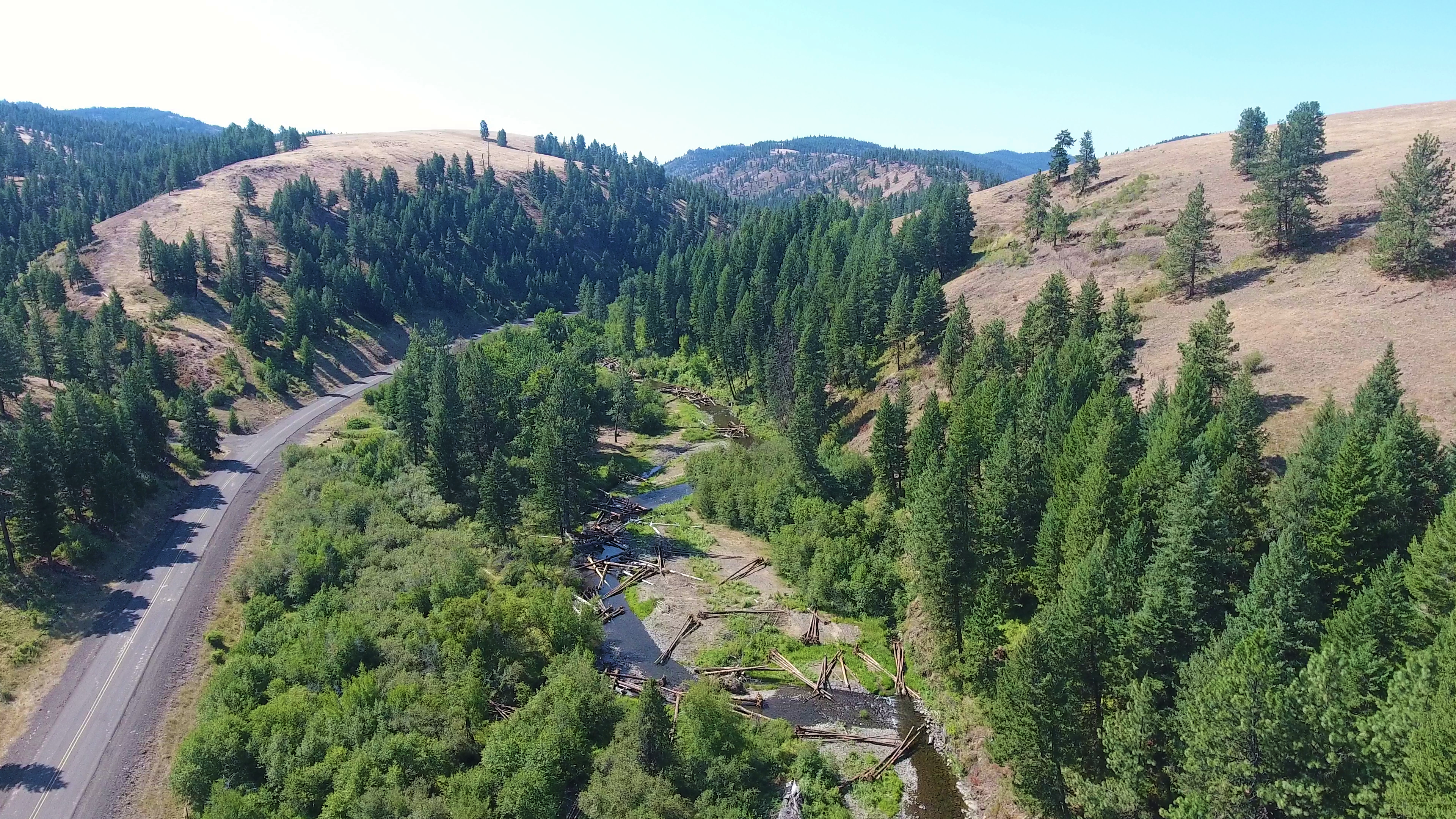 | Uploaded file MUGRR aerial photo.png |
| MUGRR Photo Construction | 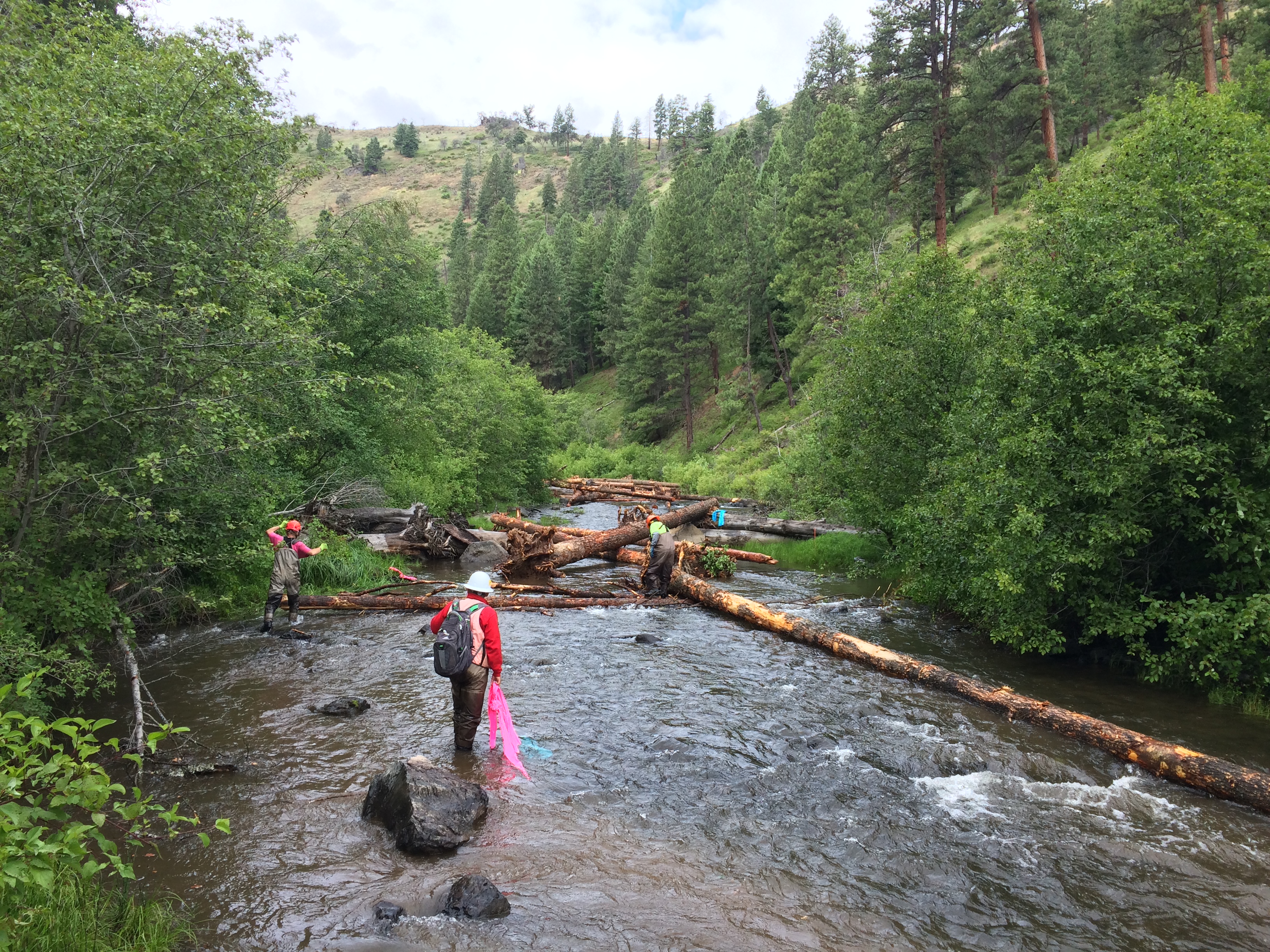 | Uploaded file Construction 1.JPG |
| MUGRR Photo Construction | 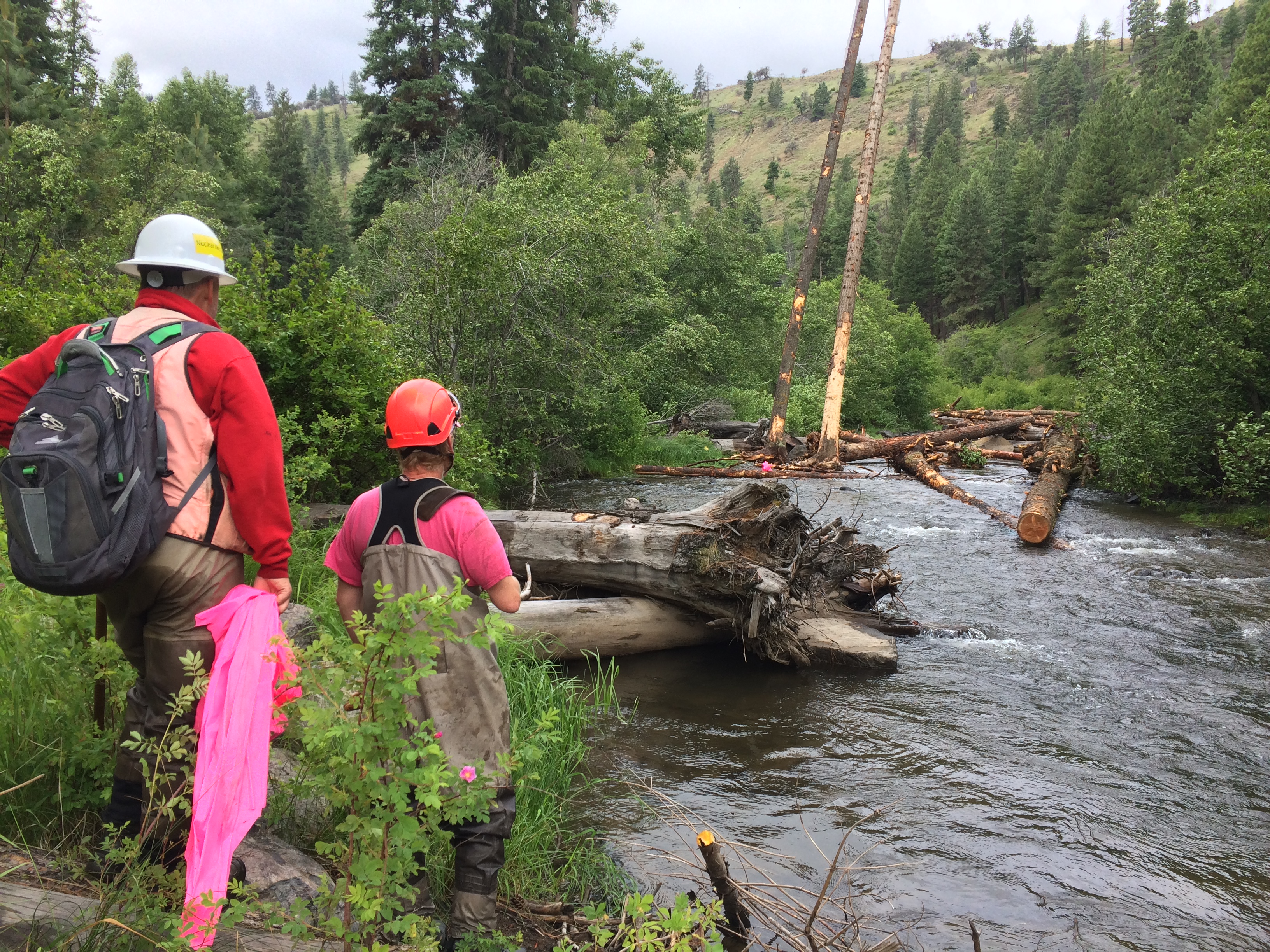 | Uploaded file Construction 2.JPG |
| MUGRR Photo Construction | 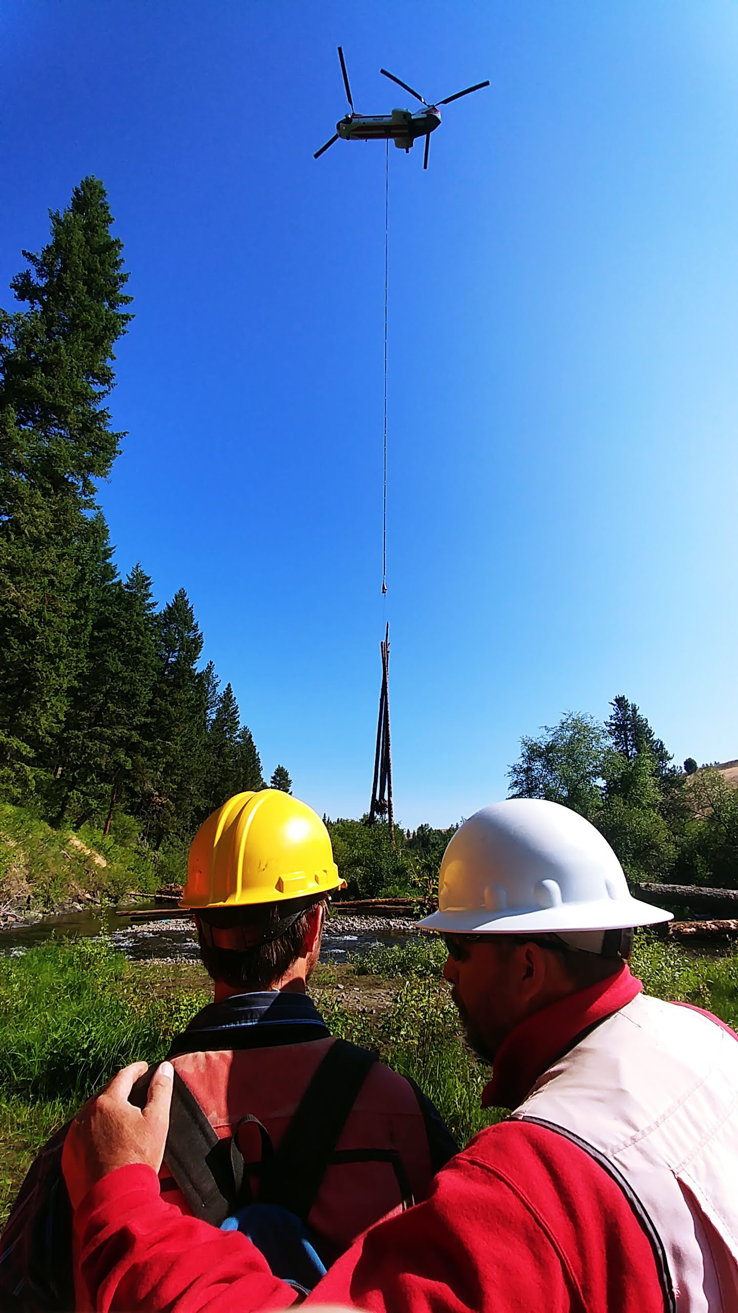 | Uploaded file Construction 3.JPG |
| MUGRR Photo Construction | 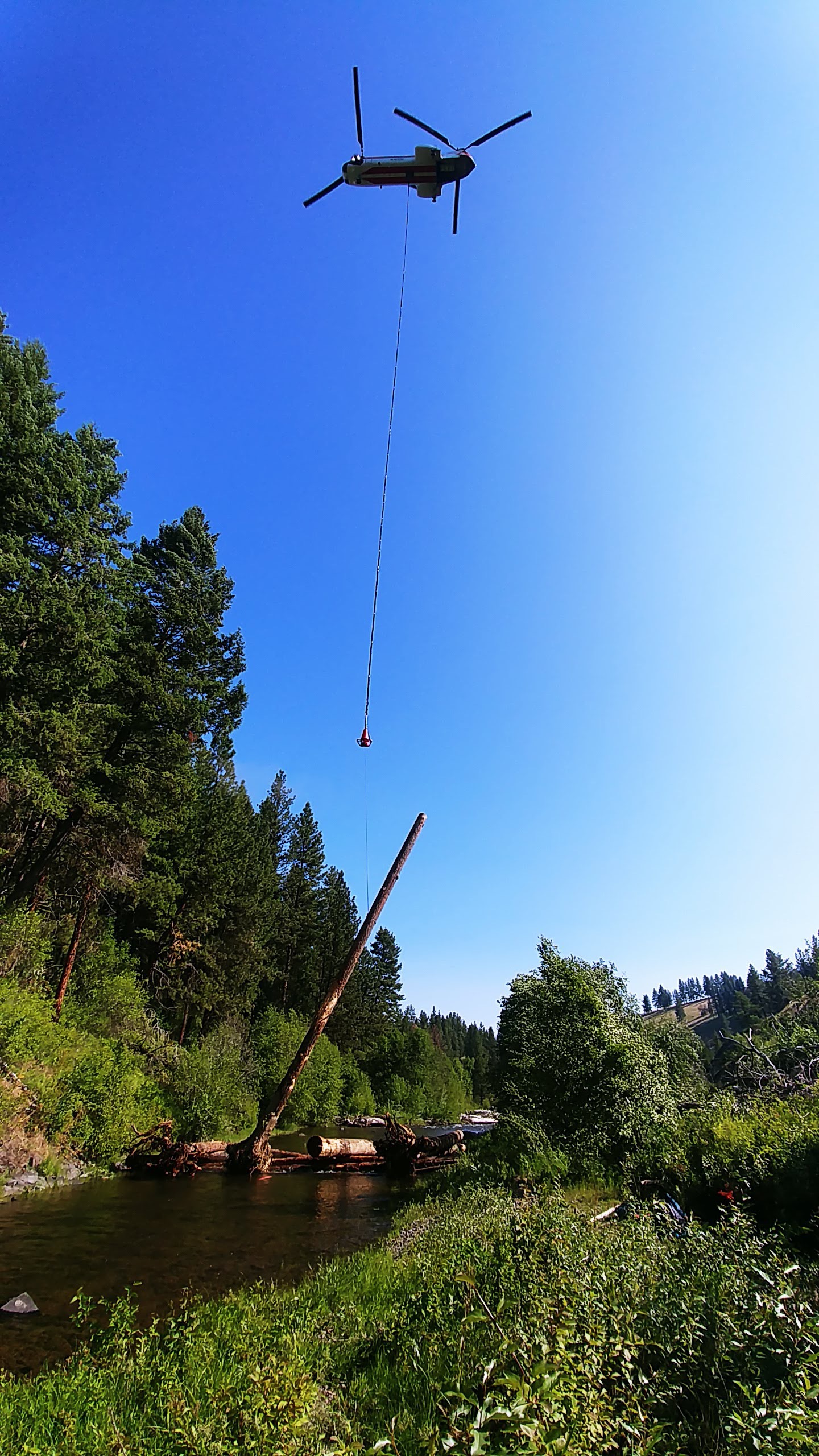 | Uploaded file Construction 4.JPG |
| MUGRR Photo Construction | 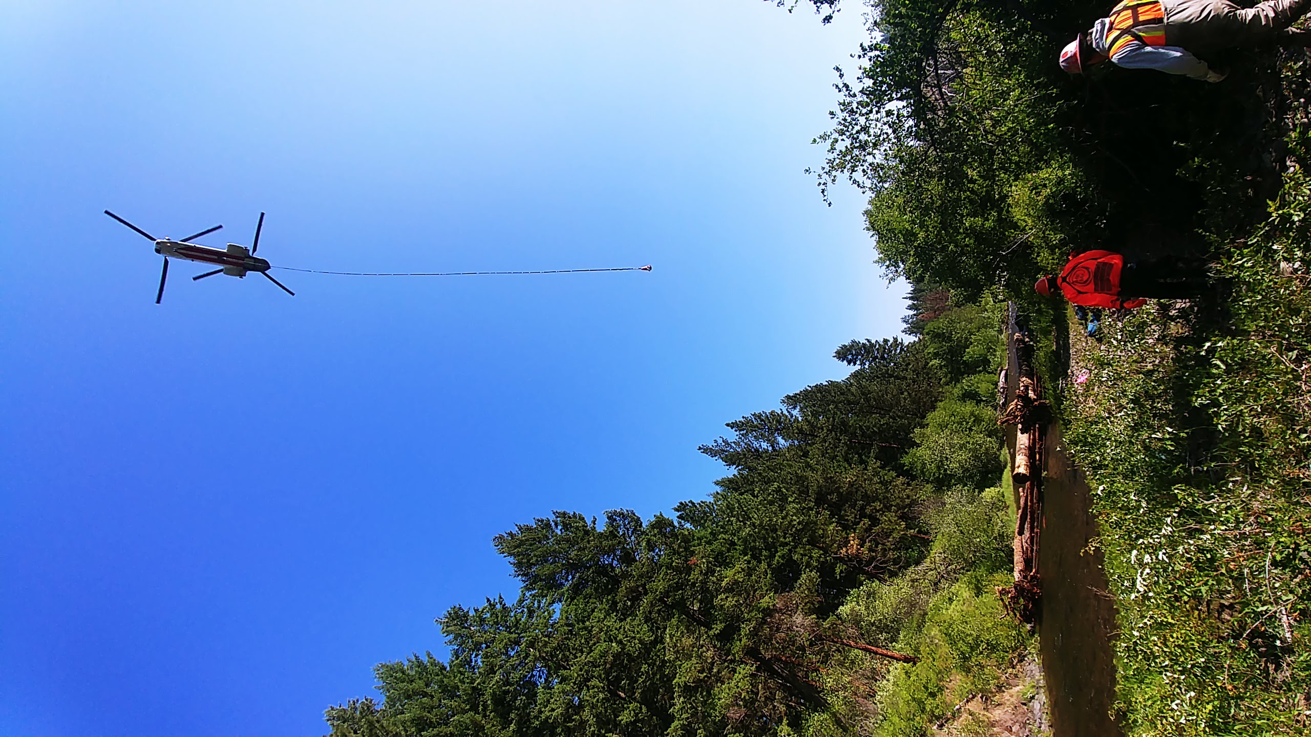 | Uploaded file Construction 5.JPG |