Longley Meadows Grande Ronde River Fish Habitat and Floodplain Restoration Project
The Longley Meadows Fish Habitat Enhancement Project is located in the Upper Grande Ronde Subbasin and encompasses nearly 2 miles of the Grande Ronde River on the Wallowa-Whitman National Forest.
.png)
The Longley Meadows Fish Habitat Enhancement Project was constructed in two phases with about 30% completed by December 2020 and continuing through summer 2021. The project is located in the Upper Grande Ronde Subbasin and encompasses nearly 2 miles of the Grande Ronde River on the Wallowa-Whitman National Forest. The project seeks to address habitat within UGR Atlas BSR Assessment Unit 11, an area that provides critical winter habitat for juvenile spring Chinook salmon and a significant opportunity to increase cold water refuge for summer rearing. Historic floodplain and stream channel alterations, including but not limited to, systematic removal of beavers, channelization, historic logging and splash-dams, agriculture, railroad and road construction, livestock grazing and vegetation clearing, and placer mining, have contributed to habitat degradation and loss of habitat suitability and capacity to support recovery of spring Chinook salmon, steelhead and bull trout. Water temperature, low stream flows, lack of large pools, channel morphology, and large wood (habitat quality and quantity) are the most critical limiting factors for these salmonid populations. Restoration objectives include increasing habitat complexity and diversity, improving water temperature conditions, improving riparian vegetation diversity, and reconnecting the floodplain. The restoration plan includes promoting an island braided channel and floodplain system through channel, floodplain, and large pool construction, development of riparian and wetland habitat, and promoting groundwater and hyporheic functions that moderate and improve water quality.
Project Lead: CTUIR
First Foods this project targets
| Water | |
| Salmon | |
| Deer | |
| Roots | |
| Berries |
River Vision Touchstones this project targets
| Hydrology | |
| Geomorphology | |
| Connectivity | |
| Aquatic Biota | |
| Riparian Vegetation |
No funders found.
File Library
| Title | File | Description |
|---|---|---|
| Longley Mdws Basis of Design Report | Longley Meadows BDR_Final.pdf | Uploaded file Longley Meadows BDR_Final.pdf |
| Longley Mdws Design Drawings | Longley Meadows 100pct Construction Drawings 600dpi.pdf | Uploaded file Longley Meadows 100pct Construction Drawings 600dpi.pdf |
| Longley Mdws Hydraulics Analysis | Longley Meadows Floodplain Hydraulic Analysis_signed.pdf | Uploaded file Longley Meadows Floodplain Hydraulic Analysis_signed.pdf |
| Longley Mdws Overview Map | Longley Meadows Overview Map.pdf | Uploaded file Longley Meadows Overview Map.pdf |
| Longley Mdws Project Completion Report | Longley Meadows Completion Report February 2022.pdf | Uploaded file Longley Meadows Completion Report February 2022.pdf |
| Longley Mdws Project Summary Snapshot | Longley Meadows Snapshot Yr 1 2020.pdf | Uploaded file Longley Meadows Snapshot Yr 1 2020.pdf |
Image Gallery
| Title | File | Description |
|---|---|---|
| Longley Mdws Aerial Photo Dec 2020 | 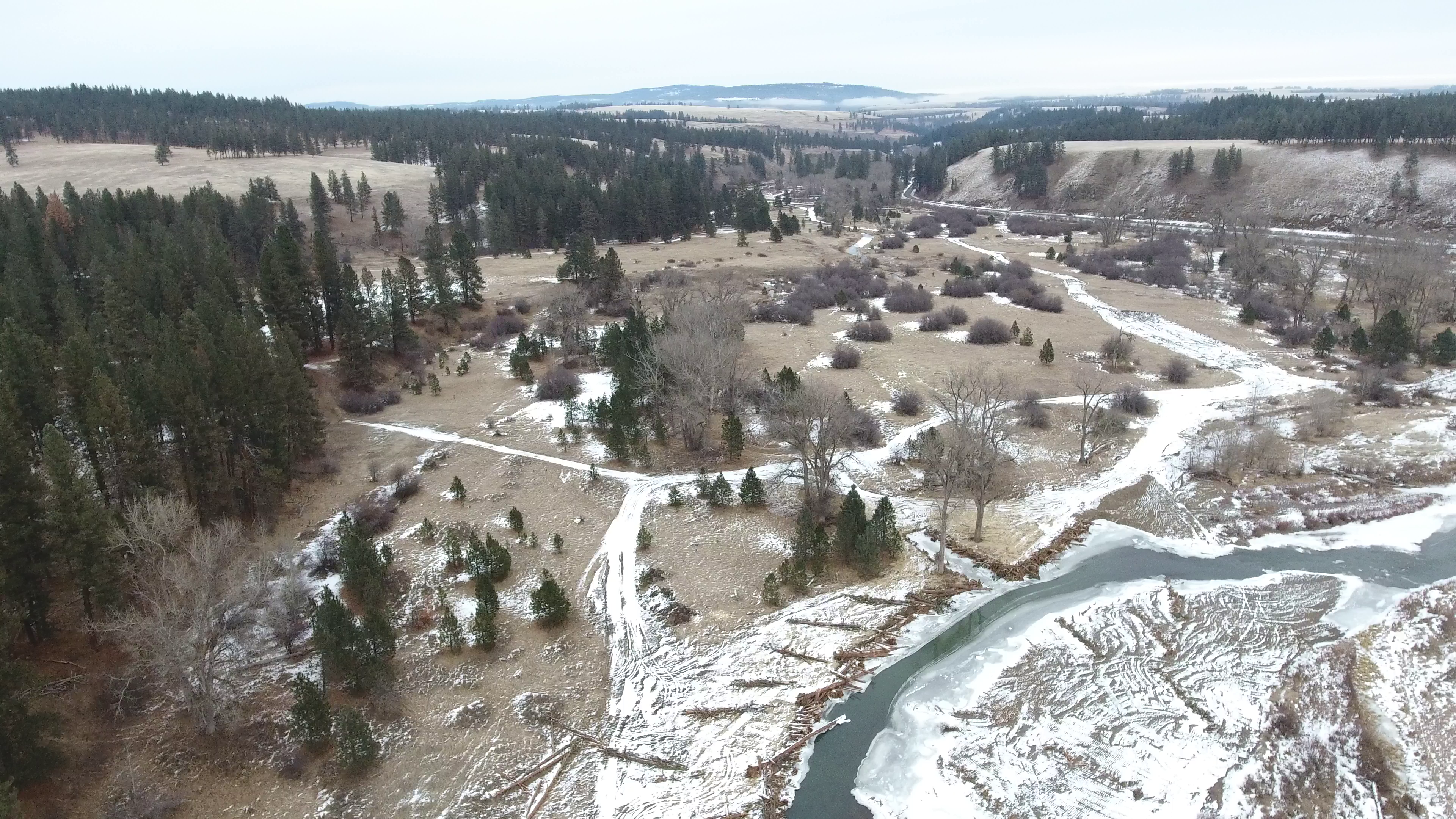 | Uploaded file Drone 2.png |
| Longley Mdws Aerial Photo Dec 2020 | 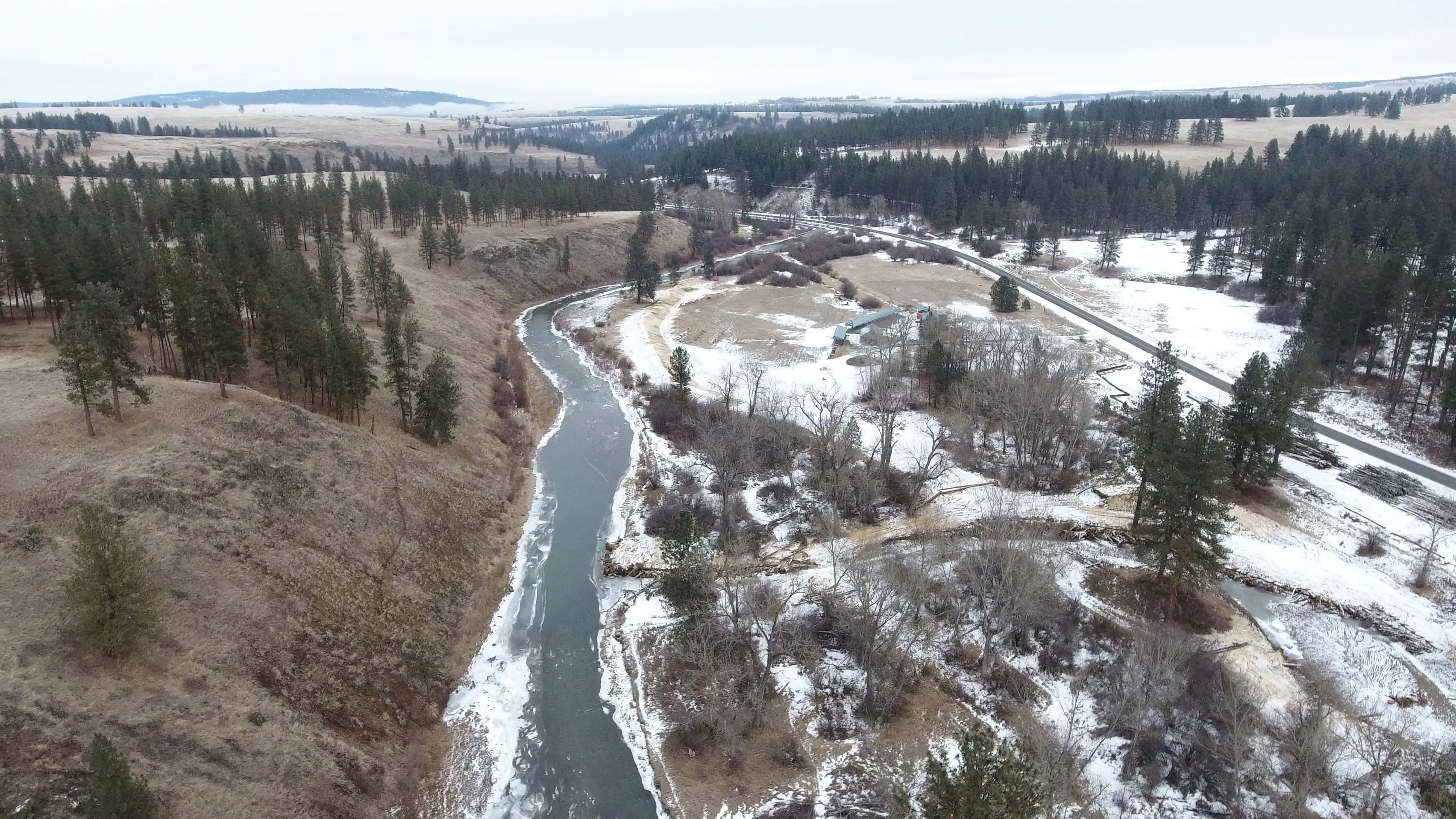 | Uploaded file Drone 3.png |
| Longley Mdws Aerial Photo Dec 2020 | 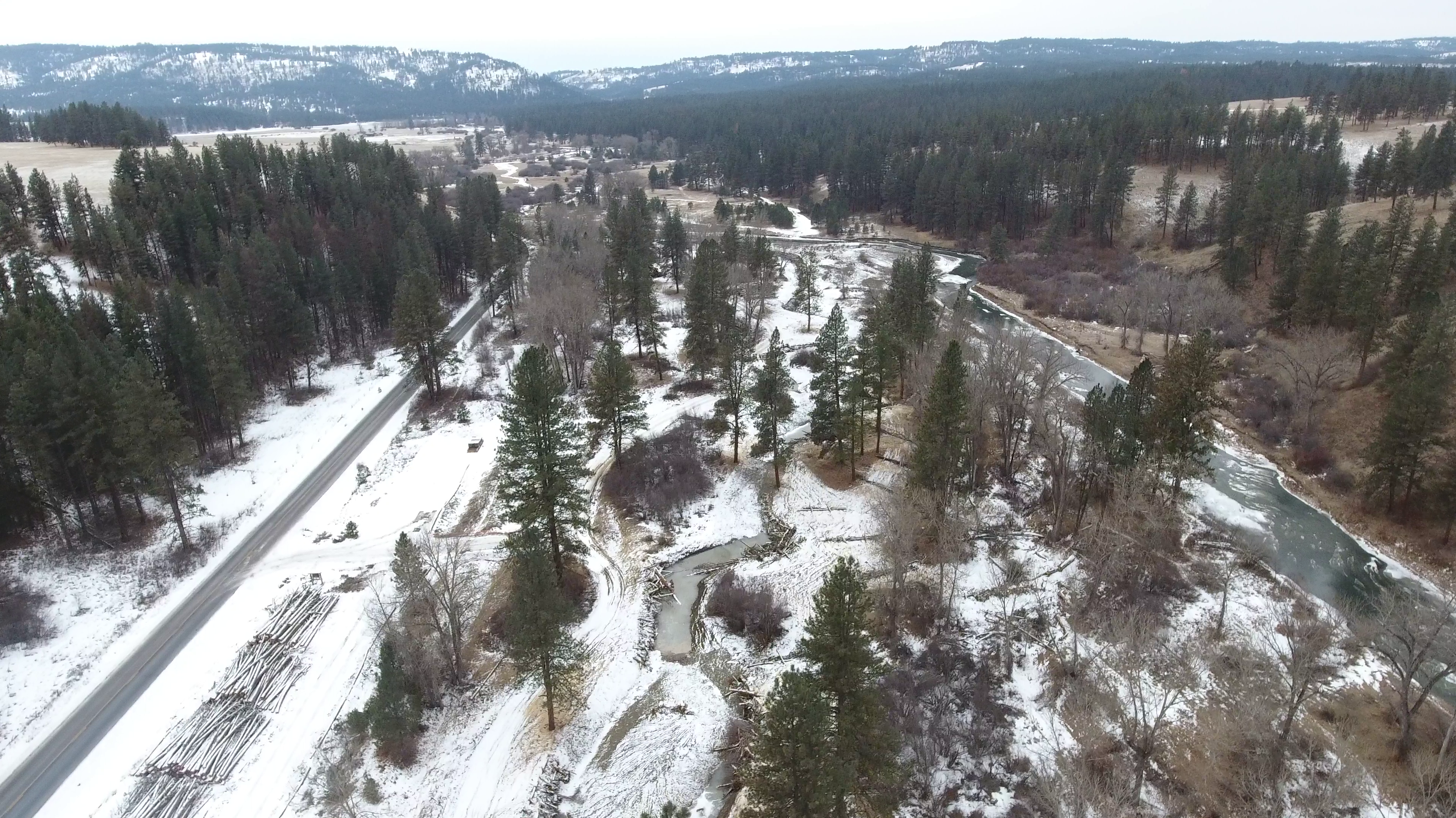 | Uploaded file Drone 4.png |
| Longley Mdws Aerial Photo Pre-project | 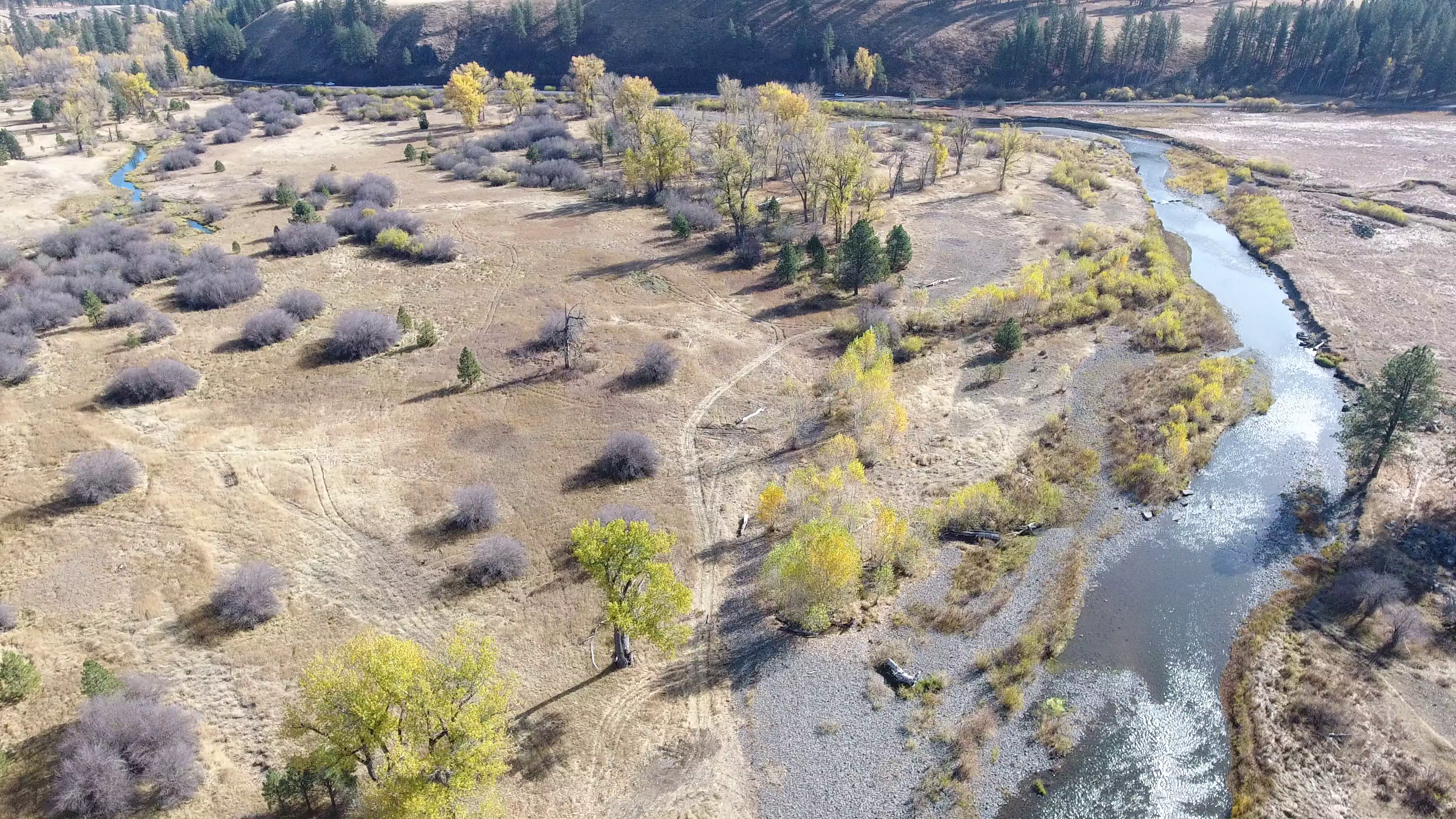 | Uploaded file Drone 1.png |
| Longley Mdws Photo, Construction | 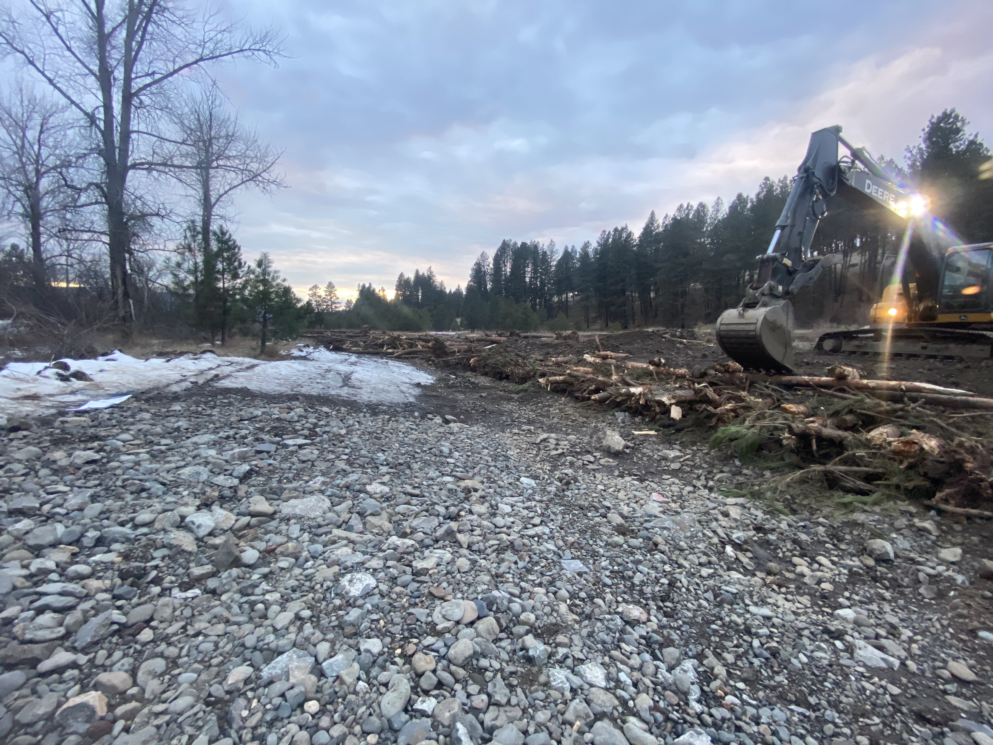 | Uploaded file Const. 1.JPG |
| Longley Mdws Photo, Construction | 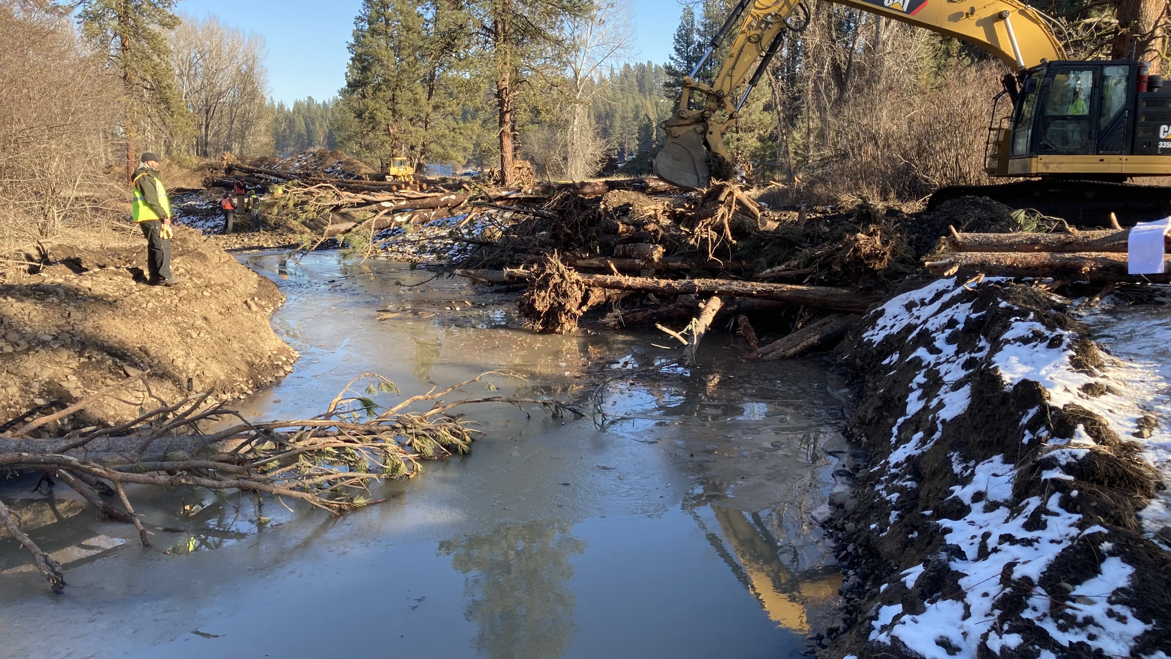 | Uploaded file Const. 2.JPG |
| Longley Mdws Photo, Construction | 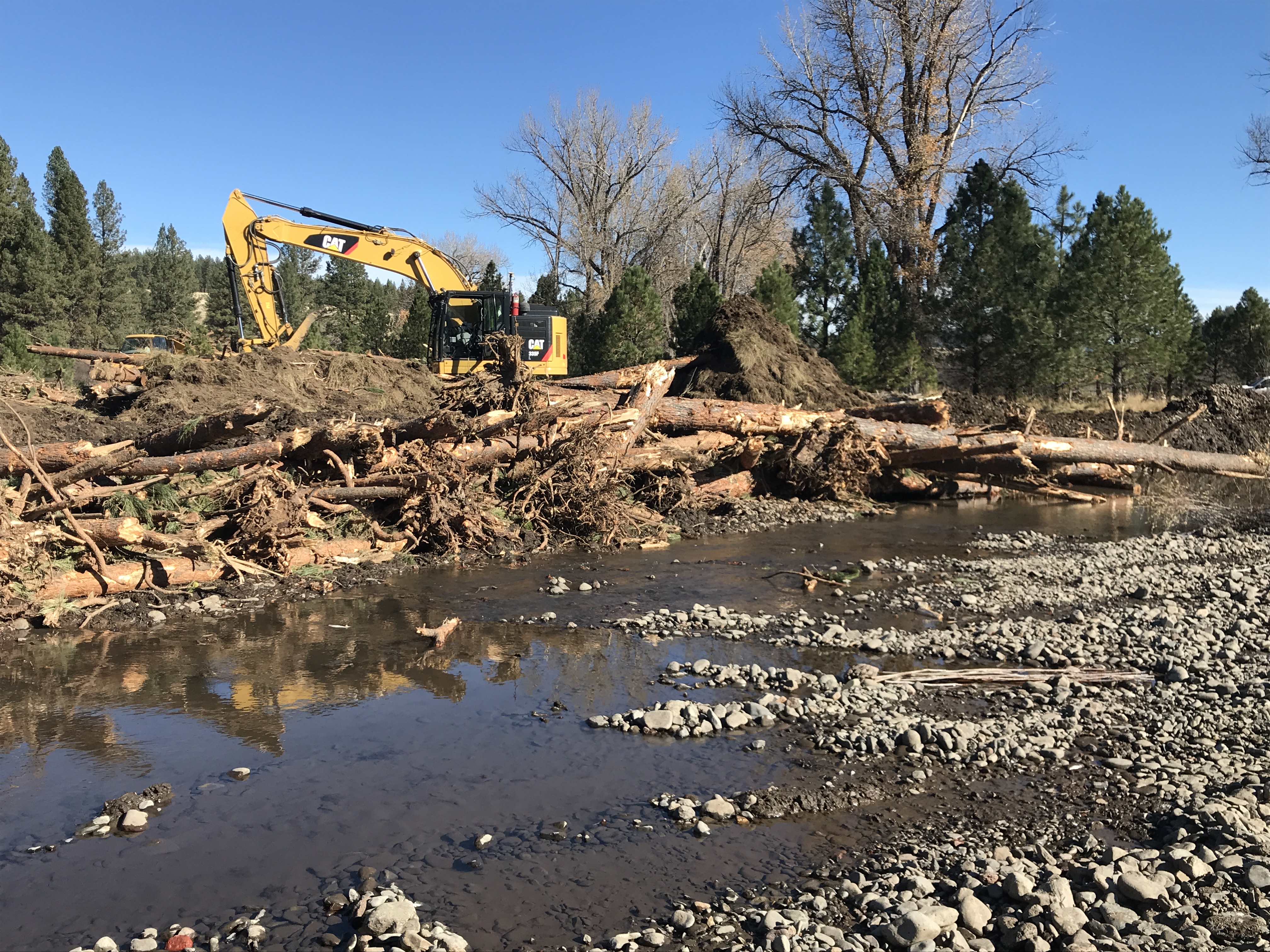 | Uploaded file Const. 3.JPG |
| Longley Mdws Photo, Construction | 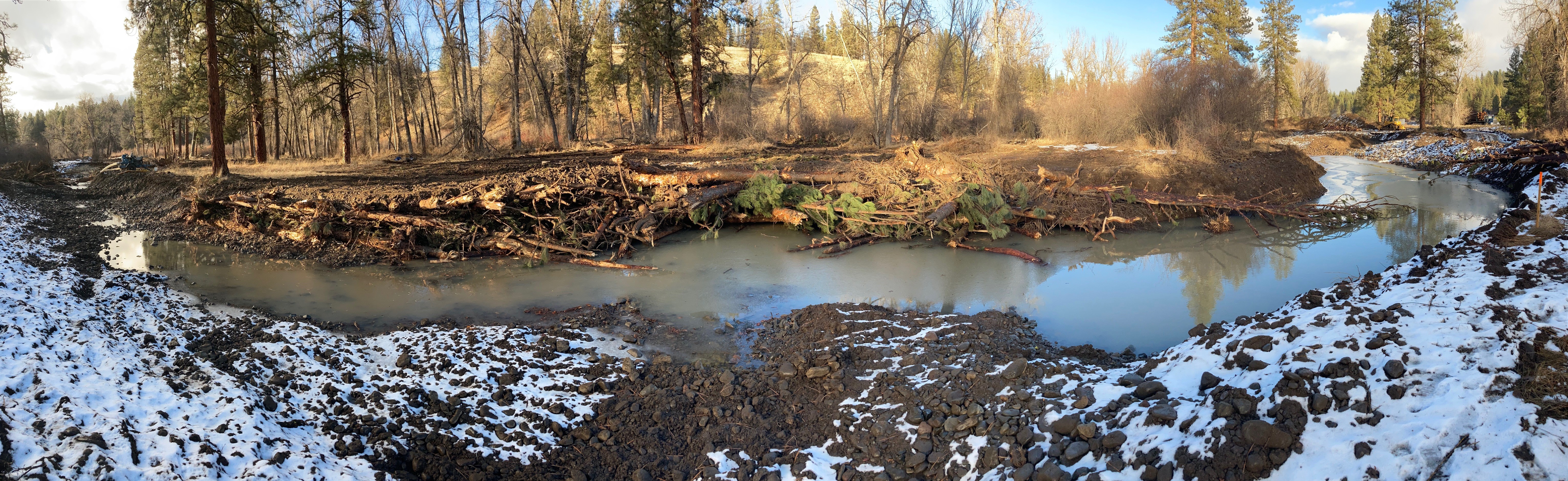 | Uploaded file Const. 4.jpg |