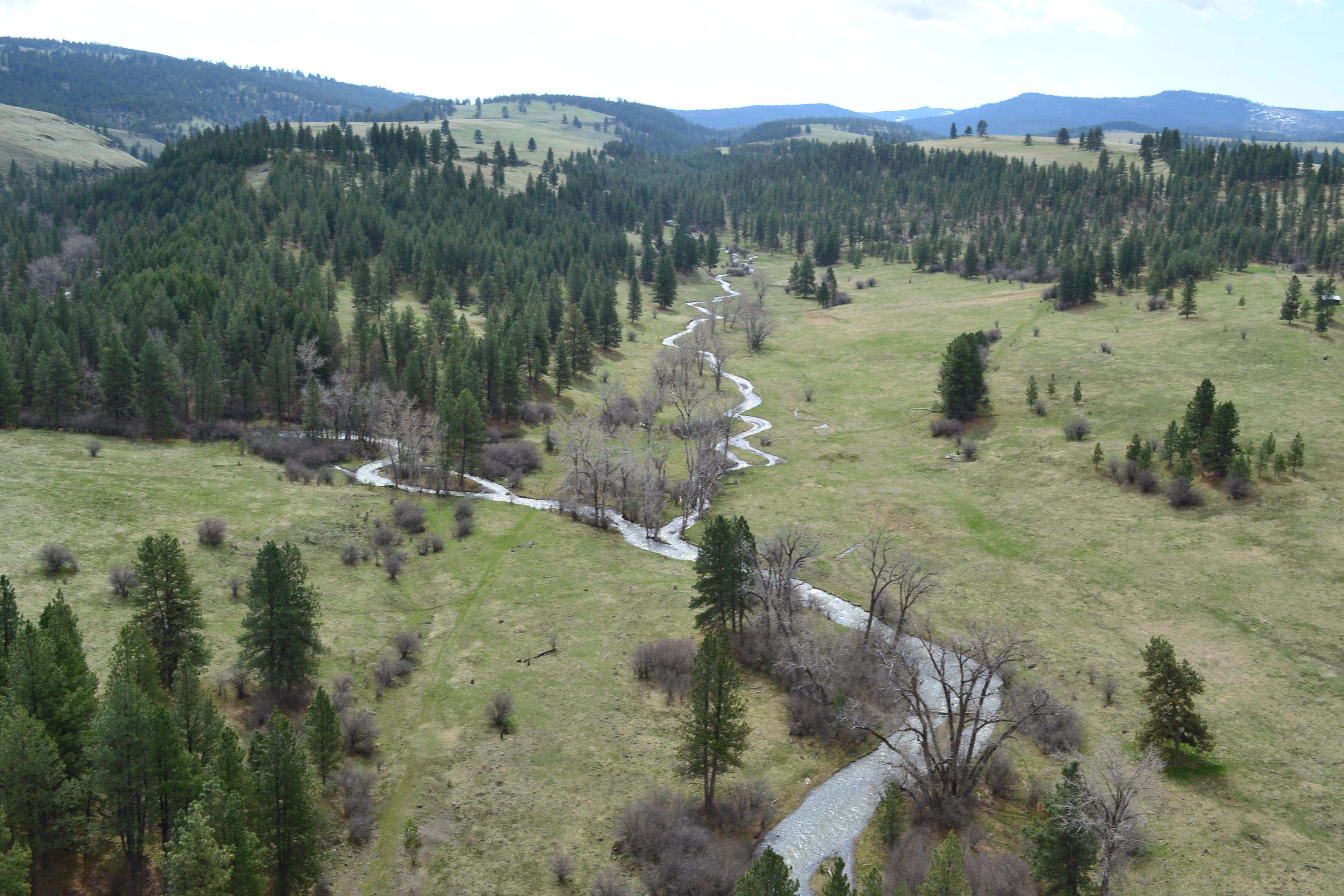
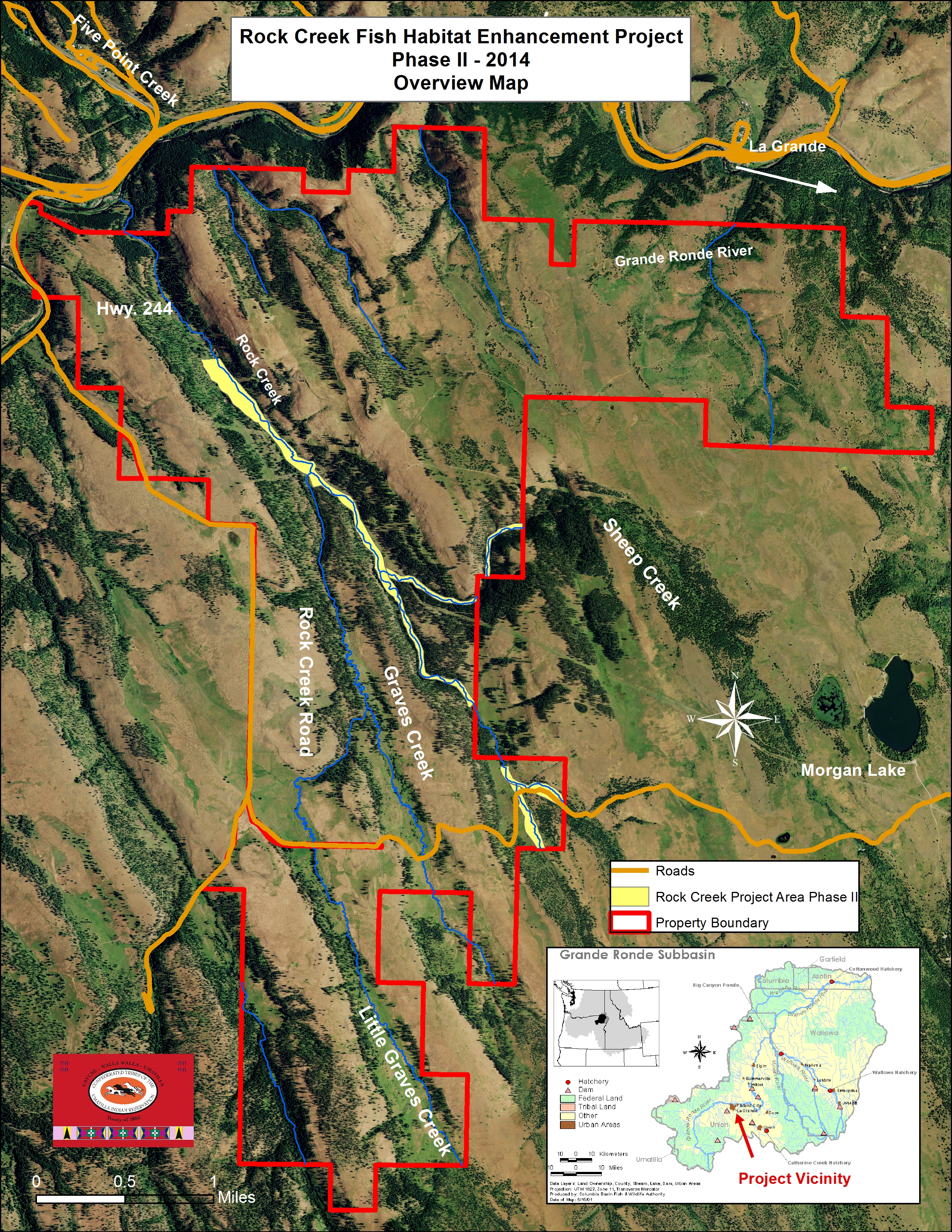
This Rock Creek Project encompasses nearly 16 miles of fish habitat on Rock, Little Rock, Sheep, Graves, and Little Graves creeks within the UGC-2 and UGS-16 recovery plan assessment units. UGS-16 has been identified by the BiOp Expert Panel as one of the highest priority geographic units to protect and restore summer steelhead habitat. UGC-2 is identified as having high intrinsic potential for Chinook in the lower reaches of Rock Creek and low to medium intrinsic potential for Chinook within upper stream reaches. Rock creek is located in Upper Grande Ronde within Atlas Biologically Significant Reach 12, Tier 3. Phase 2 of the project was constructed in 2014 and sought to address habitat limiting factors along approximately six miles of mainstem Rock Creek, Little Rock Creek, Graves Creek, and Sheep Creek. The project area is located 6.8 miles west of La Grande, Oregon and is located on privately owned land.
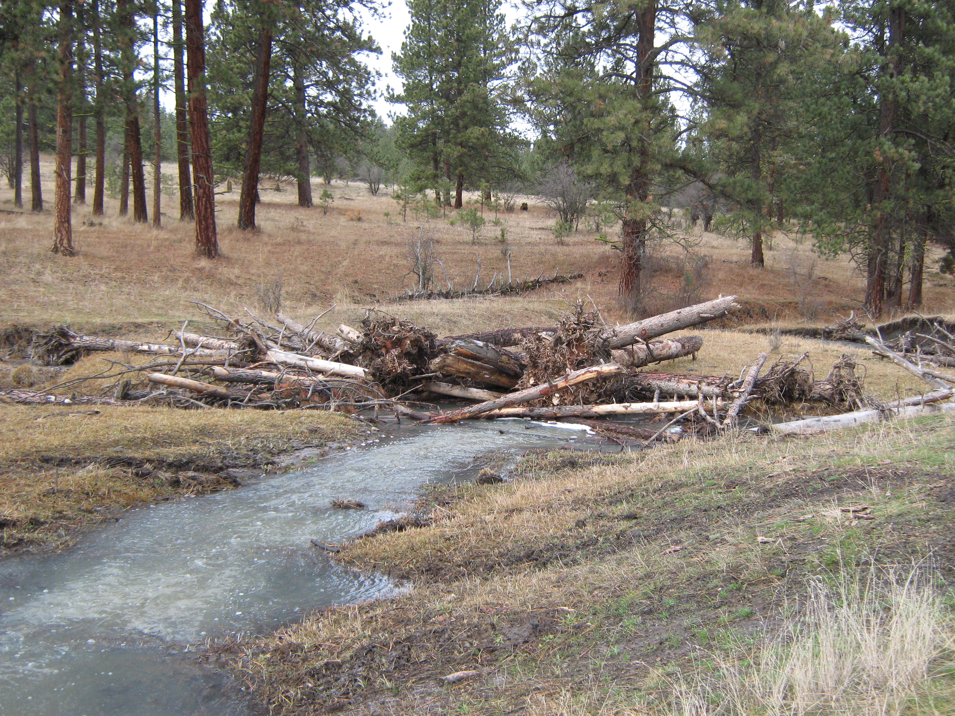
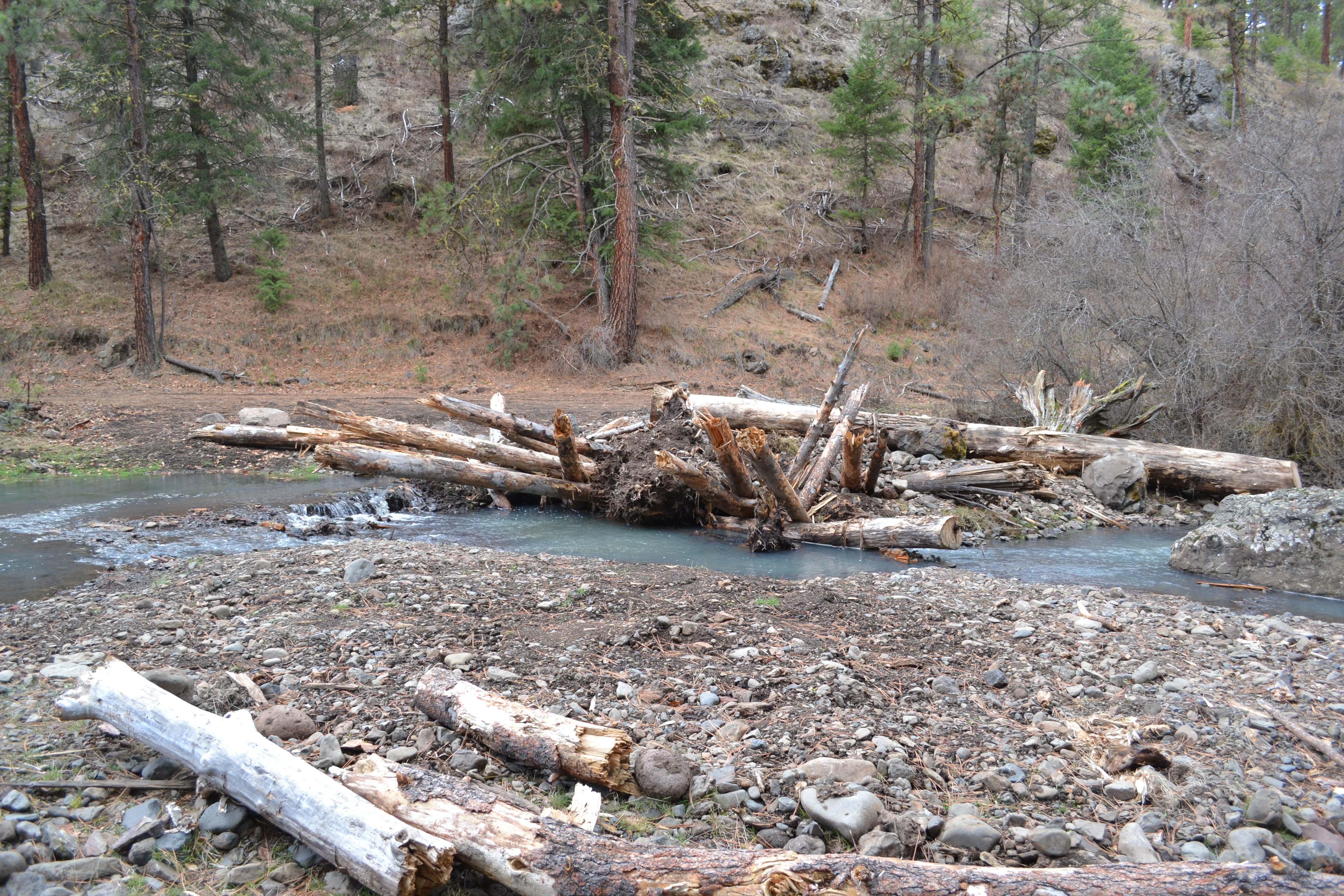
Anthropomorphic alterations to the Rock Creek watershed have resulted in limited habitat complexity, floodplain confinement, channel entrenchment, increased slope, coarsened streambed sediment and loss of spawning habitat, streambank erosion, loss of wetland and riparian plant communities, poor thermal diversity, chronic summer high water temperatures and generally homogenized and degraded fish habitat
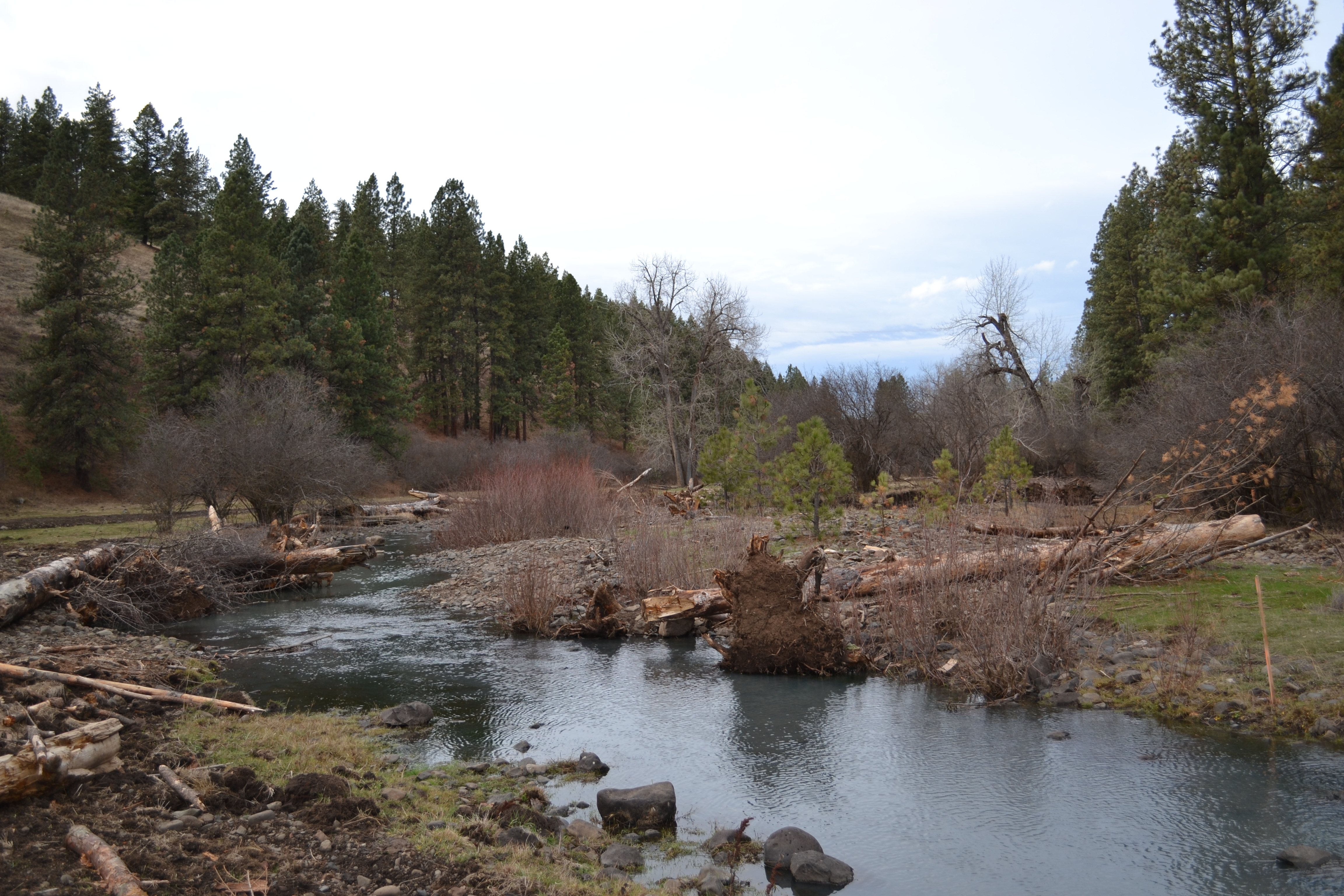
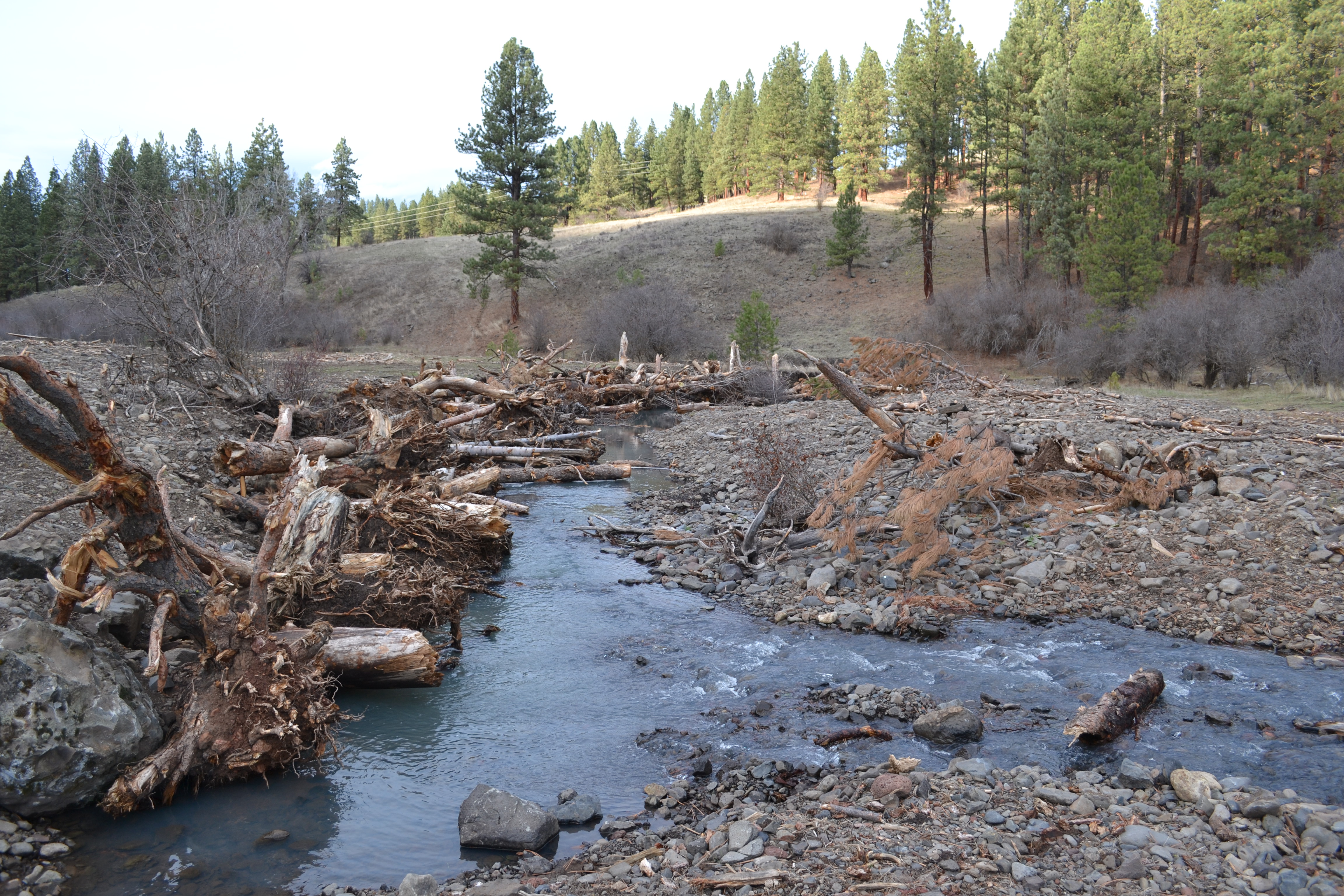
The scale of the restoration project has the potential to provide a refuge for various life stages of threatened and endangered Columbia Basin summer steelhead and Chinook salmon. The presence of juvenile Chinook within this degraded system emphasizes the need for these restoration efforts and is an indication of the importance of these tributaries in the recovery of salmonid fish populations within the Grande Ronde Basin. The potential of altered reaches within the project include meandering riffle-pool dominated stream types developed within a diverse and complex riparian floodplain. Large wood complexes would be installed to enhance large pool habitat, providing complexity, cover, and velocity refuge. Boulder Clusters would be placed between meanders and within the utility right-of-way confined channel to increase habitat complexity, velocity refuge, and forage locations. While it is recognized that the primary channel form is a single-threaded plan form, diverse floodplain micro habitats in the form of active side channels, backwater areas and low velocity zones are desired features for increasing habitat complexity for target fish species. Creating additional side channel and off channel habitat is a primary objective for overbank floodplain areas. For the active channel design along Rock Creek, channel stability represents a condition where several hydraulic variables are balanced to achieve a state of dynamic equilibrium that satisfies traditional hydraulic design principles. Channel stability implies that although the channel pattern may change over time, the channel's overall cross-section area and slope remain consistent and the rates of erosion and deposition are approximately balanced as the channel pattern changes. It is understood that while geomorphic change is anticipated within the project reach, the rate and magnitude of channel and floodplain adjustment will be managed by the incorporation of specific designed elements that will be engineered to accommodate long term sustainability.